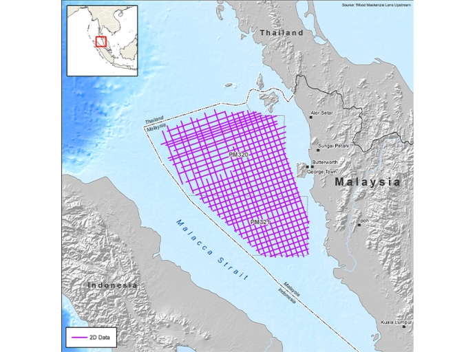
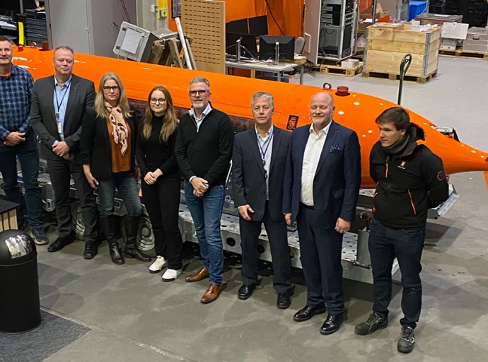
In September, Argeo announced the purchase of three new advanced AUV’s from Kongsberg, two Hugin Superiors and one Hugin 6000. On November 14, the contracts for all three vehicles were formally signed at Kongsberg’s premises in Horten.
Subsea & Survey
All Stories
Phoenix International Holdings, Inc. (Phoenix), under the direction of the US Navy’s Supervisor of Salvage and Diving (SUPSALV), recovered the remaining debris of the Titan submersible from the North Atlantic seafloor near the RMS Titanic shipwreck.
Ignitis Renewables, an international green energy company, has awarded Fugro a contract to conduct a geophysical survey at Lithuania's first offshore wind farm site. This critical step in the project's development aims to enhance the understanding of seabed conditions, which will inform the location, construction and design of future wind turbines at the Baltic Sea.
CGG, in association with PETRONAS, has announced the start of the Selat Melaka 2D multi-client seismic program over the Langkasuka Basin offshore Malaysia. Located in the Malacca Strait, the project has received industry funding and will deliver early products in December 2023 and final results in August 2024.
Reach Subsea, the trusted data and subsea service provider for ocean-based industries, has signed an attractive three or five-year charter contract and additional options with Agalas for a modern IMR/Survey vessel with low emission, smart lifting arrangement and a state-of-the-art equipment package that can be adapted to several market segments, with delivery early 2026.
C.A. Richards & Associates, Inc, a Sottomarine Company, is excited to announce an agreement to represent GeoAcoustics Ltd across the 50 United States of America. The new agreement expands on the existing relationship which focused on meeting demand for GeoAcoustics’ innovative hydrographic technology primarily in Gulf States.
Fugro will showcase their latest Rapid Airborne Multibeam Mapping System, RAMMS 2.0, at this week’s Hydro 2023 conference in Genoa, Italy. RAMMS 2.0 is the world’s only airborne lidar system that can deliver both full water column imaging and high-resolution bathymetry, making it ideal for accurately mapping, monitoring and modelling coastal environments.