Current Profiling Plays a Role in China’s Maritime Infrastructure Drive
Ocean News
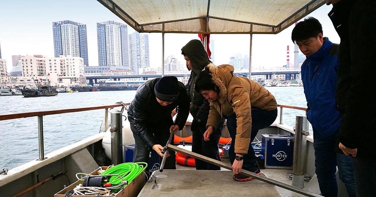
Nortek staff in China mobilizing the Signature VM package under the attentive eye of end user Wang Yan, Senior Manager of Hydrology at CCCC’s Zhongjiao No.1 Hangwu Engineering Reconnaissance Design Institute. As Signature VM is a straightforward plug-and-play system for current surveying, the crew were able to sail out for a test survey after only approximately 30 minutes of setup.
Why is current profiling proving to be an essential part of these large-scale infrastructure developments?
Accurate, speedy and cost-effective current profiling has been vital in the successful implementation of major maritime projects, ensuring that structures are built to the correct specifications.
Nortek has been able to play a role in this side of China’s economic revolution, through its collaboration with a subsidiary of China Communications Construction Company (CCCC), a Fortune 500 listed firm that has been at the forefront of the infrastructure drive.
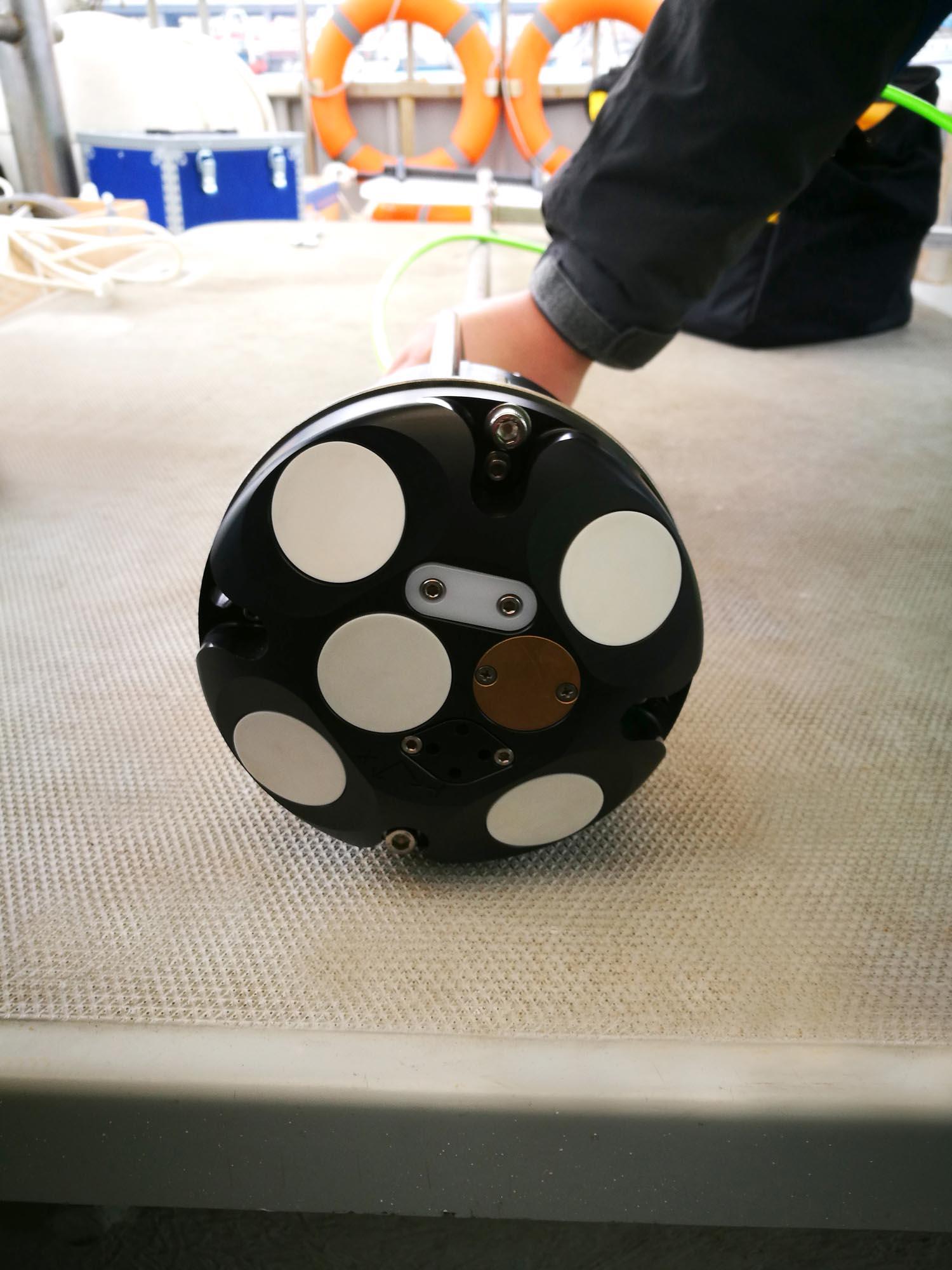 The Signature VM’s ADCP as it is mounted for current surveying in Qingdao harbor.
Obtaining current measurements in a diverse range of scenarios
CCCC’s hydrological surveyors have been using Nortek instruments on a number of projects over the last 12 years and so are well placed to assess how they perform in the field. They use both Signature1000 and Signature500 acoustic Doppler current profilers (ADCPs) to provide hydrological data that informs construction of ports and offshore developments.
Deploying the instruments as part of Nortek’s Signature VM package enables the company to obtain measurements in a diverse range of scenarios. These scenarios include cross-section, multi-point, velocity profile measurements and fixed-point measurements for offshore platforms, ports, bridges and other structures in or near the sea, as well as establishing navigation parameters at specific locations at sea.
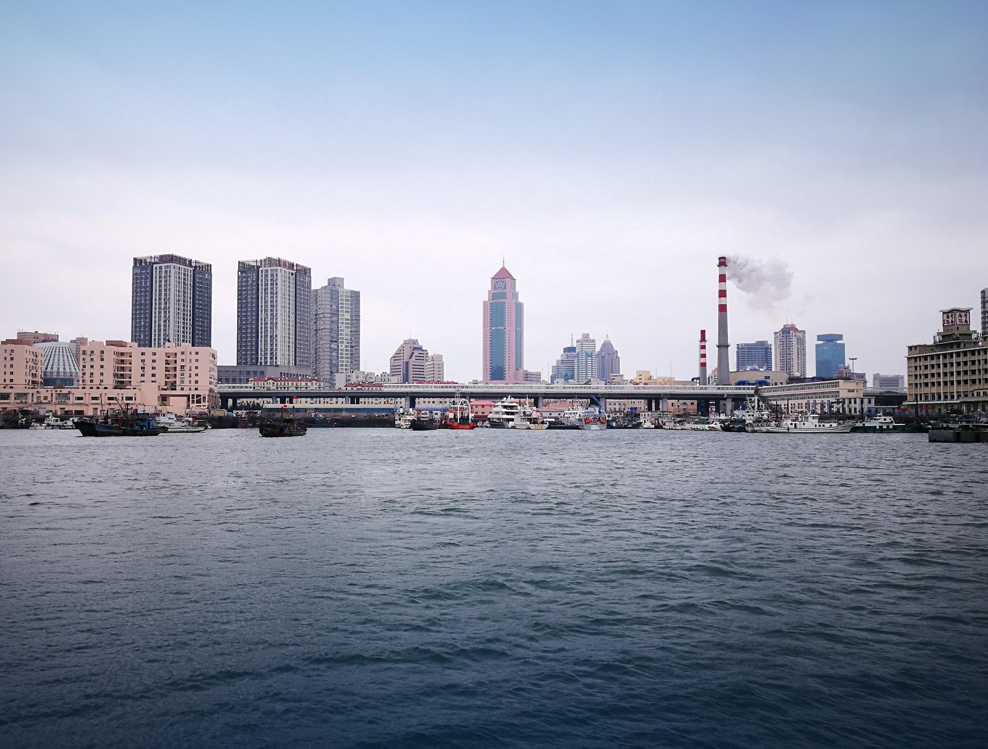 Developing infrastructure – such as the Qingdao harbor seen here – has been an essential component of China’s economic revolution. Accurate current profiling has been vital in the successful implementation of major maritime projects, ensuring that structures are built to the correct specifications.
High data quality while reducing errors and installation time
The integrated package ensures high data quality and that both errors and initial installation time are reduced. The ADCPs and the linked software provide accurate profiles in conjunction with an Advanced Navigation GNSS compass mounted on the vessel, which provides navigation and heading data based on GPS.
“Without this essential data, as well as the verification of the mathematical model, the design and construction of ports and offshore developments would have no basis,” says Wang Yan, Senior Manager of Hydrology of the Geotechnical Investigation Division at CCCC’s Zhongjiao No.1 Hangwu Engineering Reconnaissance Design Institute.
The company has become a leading force in the field of coastal engineering construction in China. Since its establishment in 1958, it has been responsible for the survey and design work behind more than 4,000 projects, and has worked on over 100 projects ranked 1st in China.
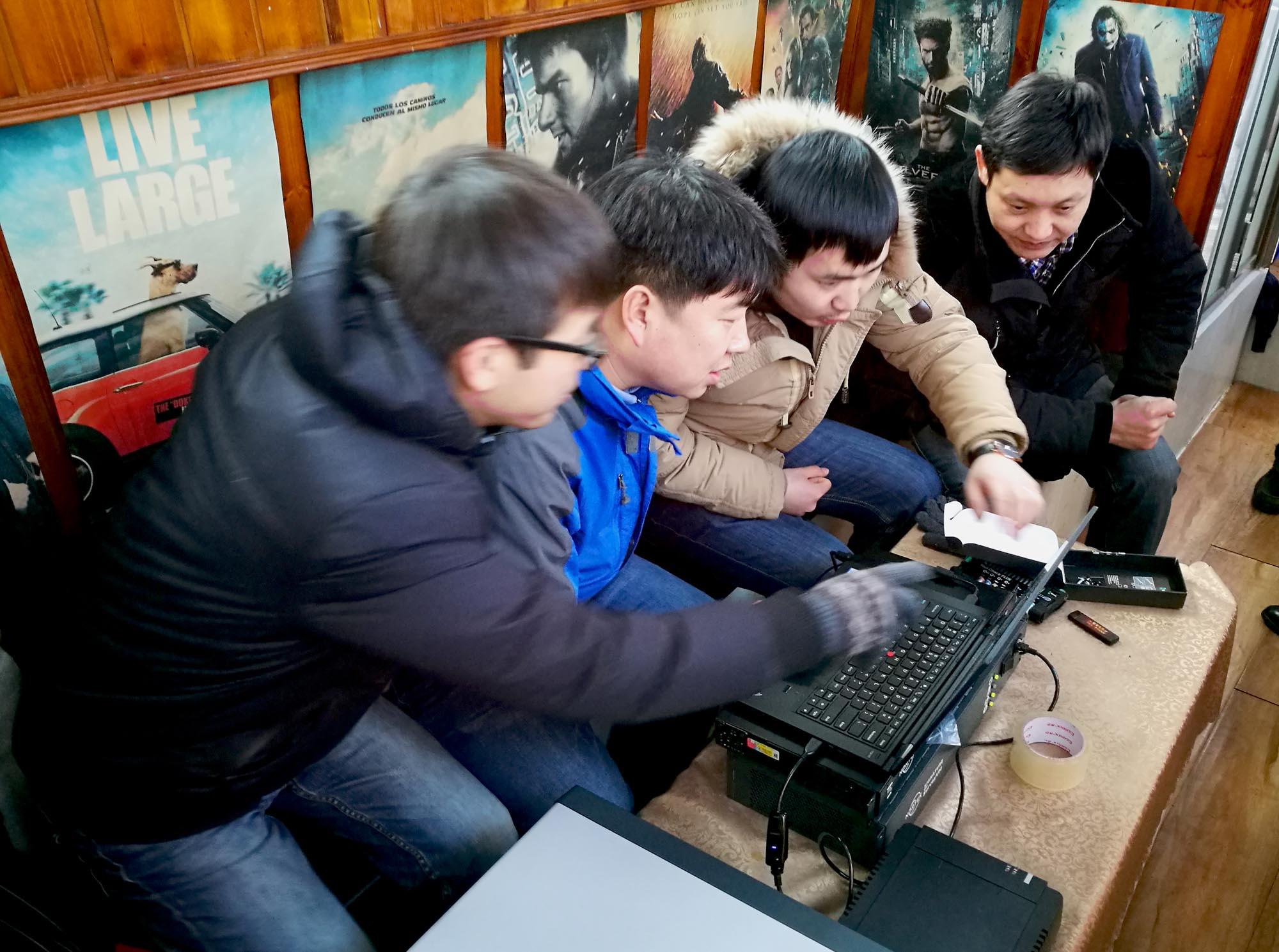 Nortek China crew explaining the Signature VM software to end user Wang Yan of CCCC’s Zhongjiao No.1 Hangwu Engineering Reconnaissance Design Institute.
Operating in complex and diverse sites
Wang says the Signature ADCP’s versatility makes it a good fit for the company, since the hydrological conditions and operating requirements at its sites are complex and diverse. He says the Signature’s ability to work both at fixed points and while navigating, and to record measurements both online or as a self-contained unit, have proved invaluable.
The main task of Wang’s hydrology survey team is to observe and analyze waves, tides and flows in different sea areas, to issue related reports and to provide basic data for the design and model checking of major offshore projects. Its work focuses include long-term and short-term observations of waves, fixed-point currents, nautical flows, sediment concentrations and tides.
Wang’s team has used the Signature VM package in a range of projects. One of these projects encompassed current measurements for a new port in the vicinity of Caofeidian District, in Hebei, China.
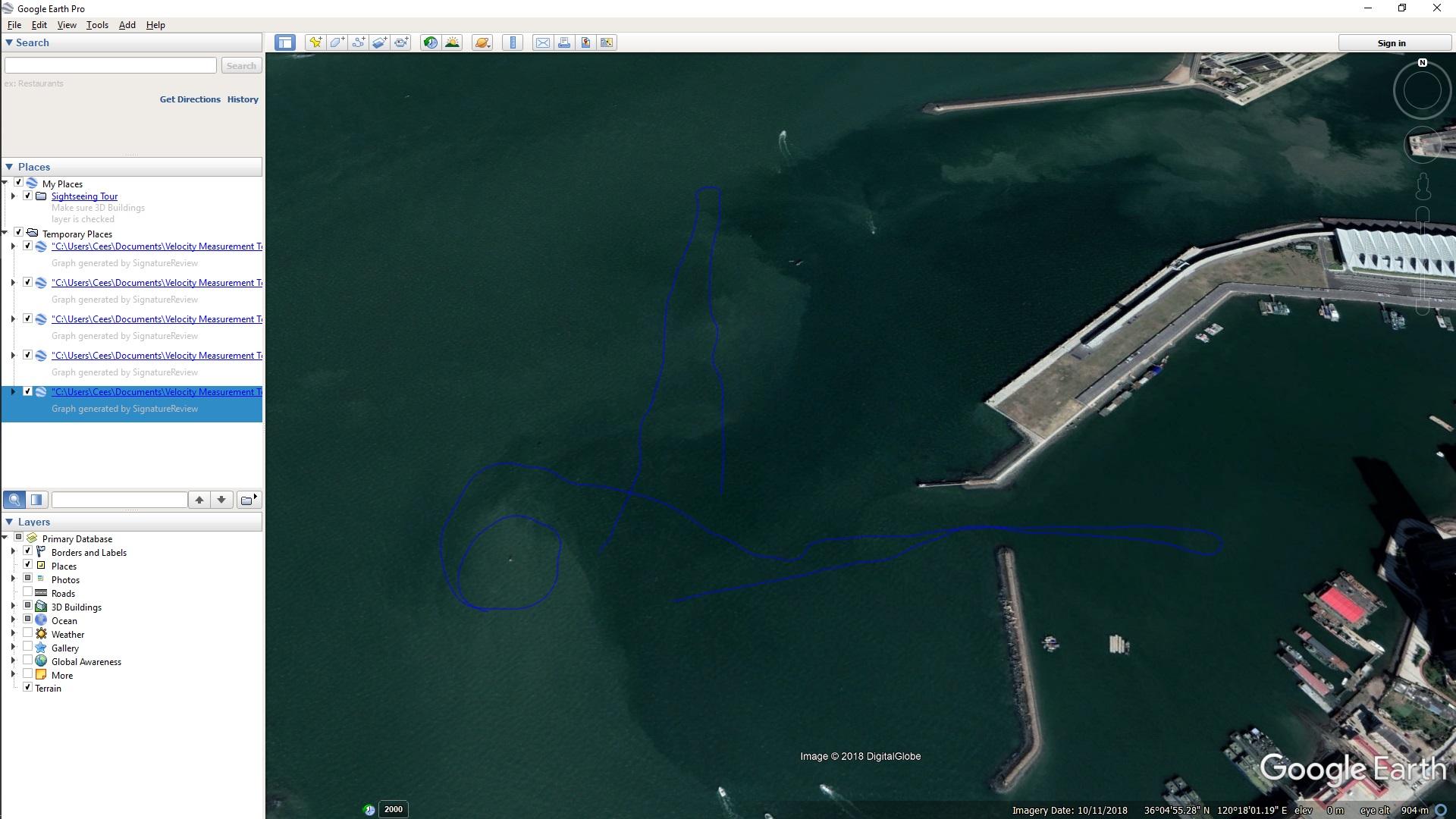 Exported data (in .kml format) showing the tracks sailed in Google Earth. The crew carried out so-called “lines” of current surveying inside and outside of the harbor to identify the differences in the currents’ velocity and direction in these two locations.
“Our customer needed site-specific raw data of currents, waves, depth, turbidity, etc. for a new port in Caofeidian. Their purpose was to use the data to build a mathematical model for the port area. This was very important for the engineering work in connection with the construction of the new port and adjacent buildings,” explains Wang.
His team selected two measurement sites according to their customer’s technical requirements.
“We surveyed along these two sites back and forth in several rounds to obtain complete datasets of the whole tidal process in the area. Each round of measurements took about an hour, and we performed the measurements continuously 24 times, or almost 24 hours in total,” says Wang.
“This was really a great challenge for the technical system, as well as for the people in my team who conducted the survey. But the results proved to be excellent,” Wang adds.
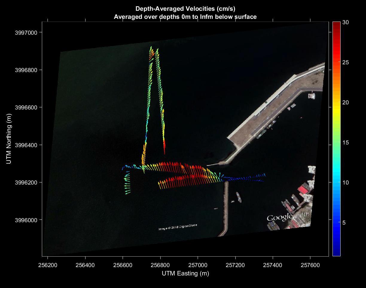 Visualization of data showing current velocity and direction.
Ease of use cuts down on manpower requirements
Signature VM is considerably less complicated to use than similar packages would have been a few years ago, when highly trained, dedicated technicians would have been required.
The relatively low skill requirements for using Signature VM means it can be deployed by a wide range of CCCC employees, Wang notes. Meanwhile, the ease and speed with which the ADCP can be attached to a vessel and then used to autonomously record multiple surveys saves time and so cuts down on manpower requirements.
“The instrument produces accurate measurement results, the whole vessel-mounted measurement process is relatively stable and there are few problems regarding bottom-tracking loss and GPS signal loss,” Wang says.