International Team Set to Drill Gas Hydrate Test Well on Alaska’s North Slope
Ocean News
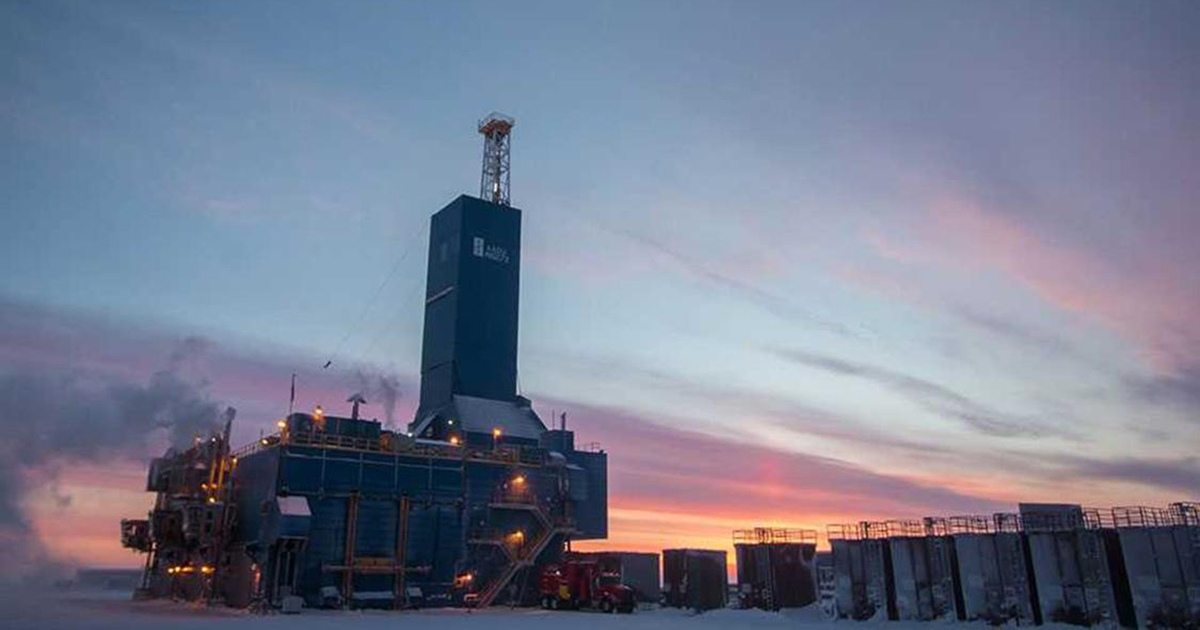
An international partnership formed to investigate the resource potential of natural gas hydrates has announced plans to drill an initial test well within the Prudhoe Bay Unit (PBU), on the Alaska North Slope. The US Department of Energy’s (DOE) National Energy Technology Laboratory (NETL), the Japan Oil, Gas and Metals National Corporation (JOGMEC), and the U.S. Geological Survey (USGS) have all played important roles in the work of the partnership.
Gas hydrates are naturally occurring combinations of natural gas and water that form in specific conditions of relatively cold temperatures and relatively high pressures. They are known to occur in abundance in northern Alaska , as well as in the shallow sediments of deepwater continental margins around the world, most notably in the Gulf of Mexico and off the southeastern coast of Japan.
Gas hydrates have been researched in the U.S. and Japan since the mid-1990s. The work of both countries confirmed the occurrence of gas hydrates, identified many technical details of its occurrence and nature, and demonstrated the technical feasibility of production.
The international partnership team, including NETL, JOGMEC, the USGS and Petrotechnical Resources – Alaska; have arranged with the Prudhoe Bay unit owners to drill, log, and gather samples to confirm the occurrence of gas hydrate at a location within the Prudhoe Bay unit.
DOE’s Office of Fossil Energy, through NETL, funded the current drilling phase of the project. NETL, JOGMEC, the USGS, and PRA have all provided technical expertise to support the planning and execution of the project.
The initial well will feature temperature and acoustic monitoring devices that will allow it to serve as a monitoring well for potential further production testing field experiments.
The effort builds upon prior gas hydrate field research conducted by both the U.S. and Japan, including successful short-duration tests in Canada in 2002, 2007, and 2008; in Alaska in 2007 and 2012; and offshore Japan in 2013 and 2017. However, the cost and complexity of arctic and deepwater marine research has limited field testing programs to relatively short duration.
The next critical step is for the international partnership team to conduct field experiments of sufficient duration to reveal how gas hydrates release natural gas in response to reservoir depressurization. The site in Alaska has the potential to provide a unique opportunity to conduct experiments over many months because the partnership with industry will allow access to sites on a year-round basis.
The collaborative effort has benefitted from the support of the Alaska Department of Natural Resources to facilitate gas hydrate evaluation in Alaska. It follows efforts by USGS and NETL earlier in 2018 to characterize methane hydrate deposits along the Mid-Atlantic margin.
Cruise Gathers Seismic Data on Mid-Atlantic Methane Hydrate Deposits
An interagency federal research cruise this past summer on the University of Delaware’s research vessel Hugh R. Sharp, which sailed along the Mid-Atlantic margin to characterize methane hydrate deposits, yielded 2,000 km of Multi-Channel Seismic (MCS) System data that confirmed previously detected methane hydrates and discovered new deposits. NETL supported the cruise.
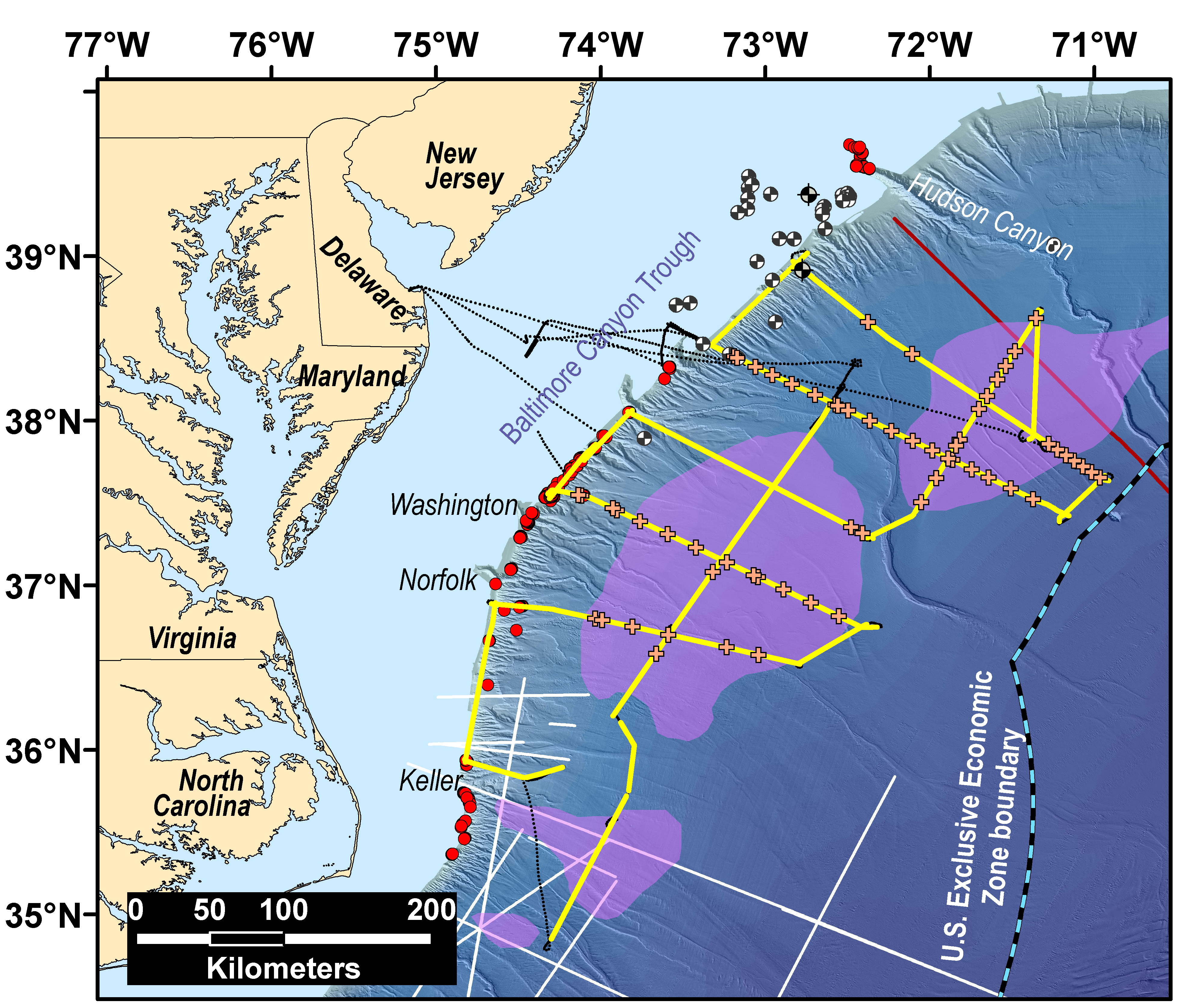 Matrix Cruise Study Area: Multichannel seismic lines acquired during the 2018 MATRIX program are shown in yellow, with the locations of sonobuoy deployments indicated by orange crosses. Dotted black line is the track of the R/V Hugh R. Sharp when seismic data were not being acquired. The MATRIX surveys sampled through three large areas (purple) identified by BOEM as prospective for gas hydrate occurrences. Seismic lines in burgundy and white denote data acquired by the USGS during the 2014 ECS survey and by the academic community during the 2014 ENAM survey, respectively. Red circles denote the locations of seafloor methane seeps, and black and white circles represent wells drilled in the 1970s and 1980s. Image courtesy of Carolyn Ruppel, Woods Hole Coastal and Marine Science Center.
A methane hydrate is a cage-like lattice of ice that contains trapped molecules of methane, the chief constituent of natural gas. If a methane hydrate is warmed or depressurized, it reverts to water and natural gas. When brought to the earth's surface, one cubic foot of gas hydrate releases up to 180 cubic feet of natural gas, making it a potentially massive new energy source. Hydrate deposits occur under Arctic permafrost and beneath the ocean floor along continental margins, like the Mid-Atlantic.
This federal research effort to characterize methane hydrate deposits included the U.S. Geological Survey (USGS), the U.S. Department of the Interior’s Bureau of Ocean Energy Management (BOEM), and the U.S. Department of Energy’s (DOE) Office of Fossil Energy (FE). Under an interagency agreement with USGS, DOE, through NETL, is providing more than $1.6 million over four years for continuing methane hydrate research. The funding supported the most recent cruise, known as the Mid-Atlantic Resource Imaging Experiment (MATRIX).
The 2018 MATRIX program is the first airgun program of this size managed wholly by the USGS since 1990s. The streamer deployed for MATRIX was also the longest that the USGS has used on non-specialized vessels since the 1990s.
Researchers acquired six seismic lines running down the continental slope from the shelf-break to waters as deep as about 12,100 feet (3,700 meters) offshore New Jersey, Delaware, Maryland, Virginia, and North Carolina. MATRIX also completed three upper continental slope lines and three deepwater (more than 8,860 feet [2,700 meters] water depth) lines oriented parallel to the coastline in this sector.
The work of the cruise fills a gap in modern seismic data acquisition along the U.S. Atlantic margin and will be used by academic collaborators and other researchers.
“USGS researchers have been involved for decades in investigations that are helping us understand the full extent of the hydrate resource,” Skip Pratt, NETL Project Manager said. “We are pleased that we were able to support a project that is making important advances in understanding gas hydrates. USGS, BOEM, and DOE experts, along with the private sector and academic institutions, are all working together to gain a better understanding of the nature and distribution of marine gas hydrates.”
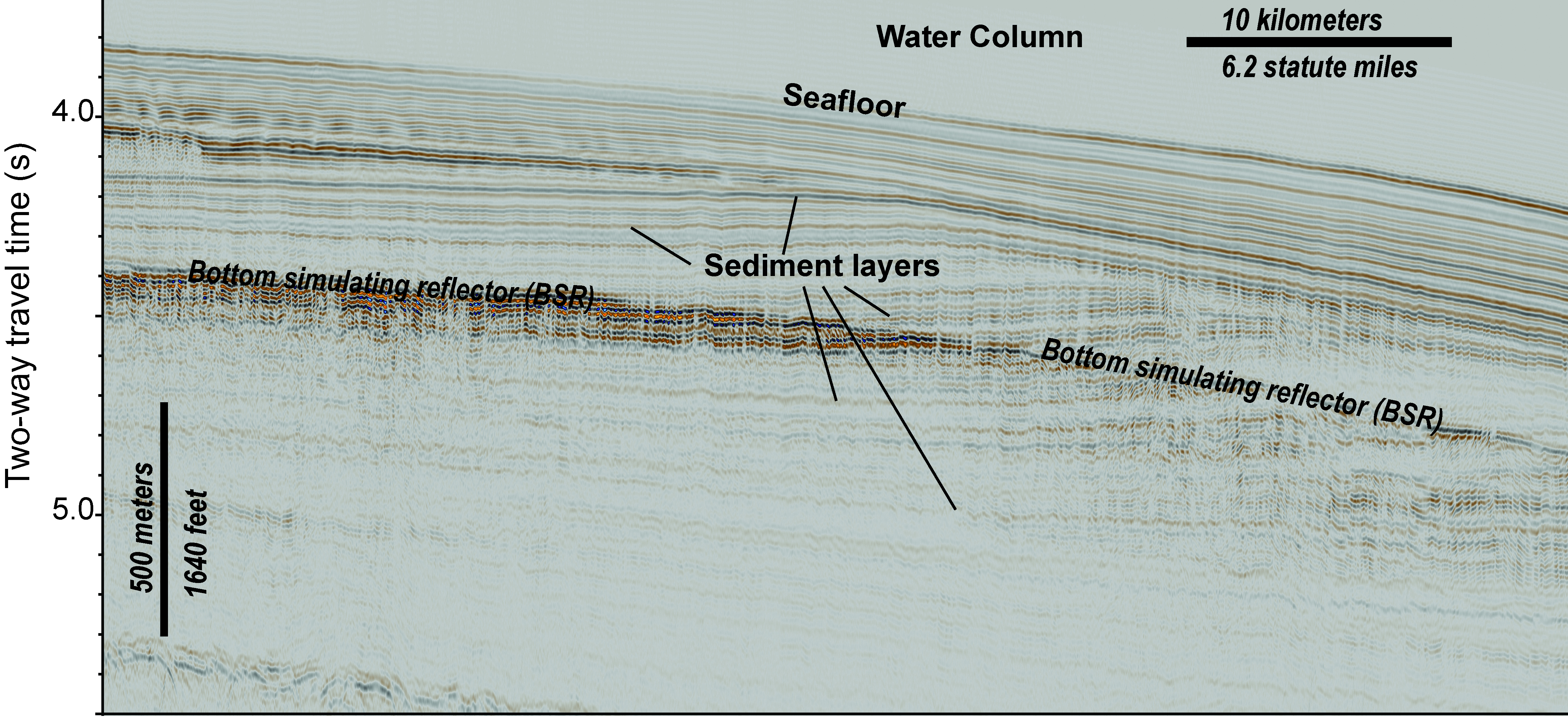 Bottom simulating reflector imaged in 2014 by the USGS along a seismic line acquired south of Hudson Canyon during the Extended Continental Shelf cruise. Image courtesy of Carolyn Ruppel, Woods Hole Coastal and Marine Science Center.