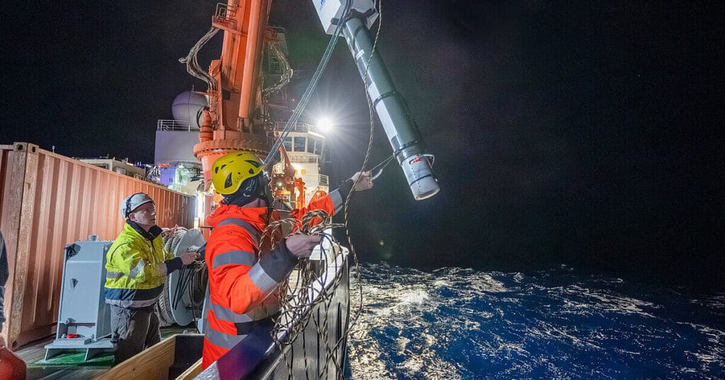
Soon Lisbonites may be able to count on tsunami warnings of half an hour or more. In the next few months, Portugal is expected to sign a deal to begin work on a new 3700-kilometer-long fiber-optic cable stretching west across the floor of the Atlantic Ocean to Madeira and the Azores, almost to the seafloor junction. One of the world’s first SMART (Sensor Monitoring And Reliable Telecommunications) cables, capable not only of carrying internet data but also monitoring the ocean above and the earth below, the €154 million cable will be able to detect tsunami waves practically where they are spawned.
For more than a decade, geophysicists have pushed telecom operators to consider SMART cables. For a 10% to 20% increase in cost, they say, companies could squeeze three simple sensors—for seafloor motion, water pressure, and temperature—into the cables’ repeaters, widened sections that amplify the optical signal every 70 kilometers or so. Until recently, it’s been hard to get operators to install them, says Charlotte Rowe, a geophysicist at Los Alamos National Laboratory. “It’s been a very slow curve, but I think it’s getting steeper now,” Rowe says.
In addition to the Portuguese cable, New Caledonia and Vanuatu, in the South Pacific Ocean, signed a deal in January 2024 to lay a 375-kilometer-long SMART cable between them, with France paying for scientific operations. In December 2023, researchers with Italy’s National Institute of Geophysics and Volcanology (INGV) laid the first smart demonstration cable in the Mediterranean Sea east of Sicily, where it can monitor the rumblings of Mount Etna. The US National Science Foundation is considering connecting Antarctica to New Zealand with a SMART cable, while several groups are seeking to connect Europe to Japan under the Arctic through the Northwest Passage.
SMART cables present an answer to a long-standing problem: How can you detect earthquakes under the oceans, which cover two-thirds of the planet? Seismometers that can operate on the sea floor are expensive to deploy, short-lived, and often can’t transmit data in real time. Deep floats, called MERMAIDs, can detect earthquakes via their reverberations in water, but only a few dozen have been deployed. Researchers are exploring methods that turn communications cables themselves into sensors, but the most sensitive techniques only reach out a couple hundred kilometers from land. Temperature and pressure measurements of the deep ocean, made by ships and Deep Argo floats, are also scant.
Submarine cables have long been an alluring target for geophysicists. They provide a constant source of power and real-time data streams, while remaining fixed in space over time—a boon for climate studies. And internet giants and telecom companies are already paying for them, smart or not.
Advocacy for SMART cables began in 2010 following an editorial in Nature by Yuzhu You, an oceanographer then at the University of Sydney. The United Nations’s International Telecommunication Union became interested and created a joint task force to pursue the idea. It focused on the three basic sensors because they gather ocean data that are already freely shared. Hydrophones were ruled out because they could turn the cables into military targets for nations eager to keep their submarines hidden from view.
At first telecom companies were reluctant, fearing the sensors would complicate the already tricky regulatory process of laying cable, says Bruce Howe, an oceanographer at the University of Hawaii at Manoa who leads the UN task force. They questioned how permitting might change, and how data would need to be shared with territories that the cable crossed, he says. “It gets into a quagmire.” But now governments such as Portugal and New Caledonia have begun to mandate that cables be smart, Howe says.
It’s no surprise that the first SMART cables are targeting regions at risk of tsunamis, says Jérome Aucan, an oceanographer at the Pacific Community, a development nonprofit in New Caledonia. Although the cables can detect the large earthquakes that trigger tsunamis, the best way to determine whether tsunami waves actually form is by looking for sudden shifts in ocean pressure—the weight of the water column—at the sea floor, where the jostling of minor swells is filtered out. This has traditionally been done with expensive mooring-buoy combos. “With a SMART cable, you put it on the sea floor for 20 years, and you can forget about maintenance,” Aucan says.
SMART cables will offer other scientific rewards, says Patrick Heimbach, an oceanographer at the University of Texas at Austin. They will help track how quickly deep ocean waters are warming because of climate change, as well as changes in large-scale ocean currents, which take heat and carbon dioxide from the surface and store it in the abyss. The sensors can also refine pictures of sea level rise, which is shaped locally by changes in currents and shifts in the sea floor, as well as by the thermal expansion of water itself and melting ice.
Besides improving earthquake and tsunami monitoring, SMART cables will also capture faint earthquake waves coming from the far side of the planet, through its interior. Those waves can serve as the equivalent of x-rays, creating pictures of features in Earth’s mantle: subducting tectonic plates, plumes that drive volcanic hot spots, and mysterious “blobs” at the mantle’s base that could be fueling the plumes. And when a cable experiences a service interruption, sensor data could help companies understand whether a submarine eruption or landslide is responsible, Rowe says.
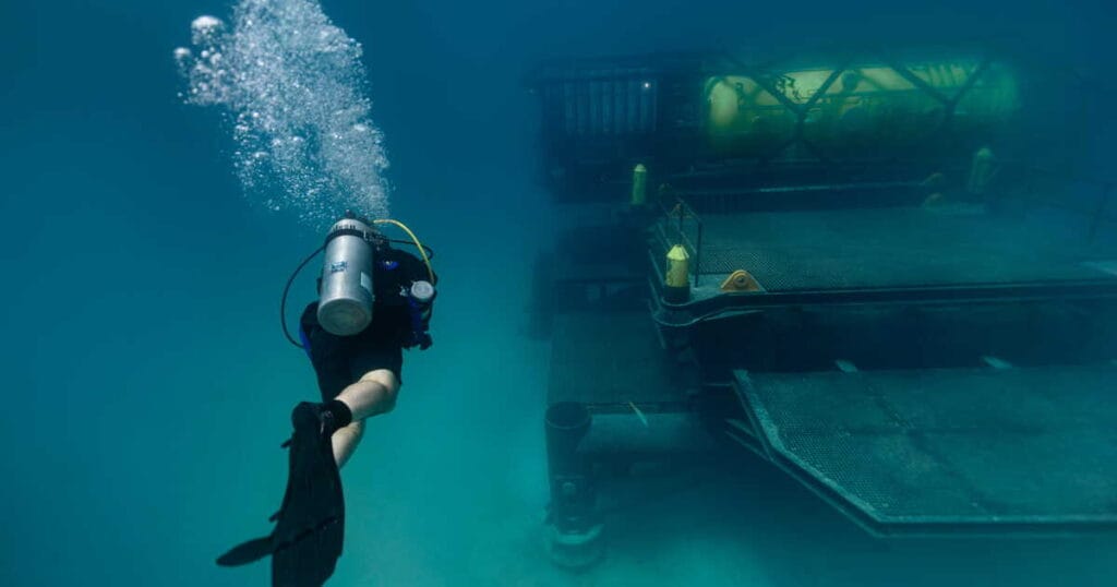
One lingering question has been how well a SMART cable will perform if it is not carefully positioned on the sea floor. INGV’s “wet demonstration” test of a 21-kilometer cable off eastern Sicily offers some reassurance, says Giuditta Marinaro, the INGV geophysicist who leads the project. The deployment showed that a SMART cable could be unspooled from a ship as fast as standard cable—an important factor, because ship time is the most expensive part of cable projects. The test cable appears to be picking up vibrations well compared with two nearby dedicated sensors, she says. “The quality right now is very good.”
Howe and his colleagues are still waiting for the first transoceanic cable to get smart. With more than 50,000 kilometers per year being laid, there are ample choices. For Barros, who helped with the Portuguese cable project, it’s only a matter of time. “In the future, I believe a lot of cables will be smart,” he says. “And people will have some extra safety in their daily lives.”