Part of the Norwegian Shelf Opens for Seabed Mineral Exploration
ON&T
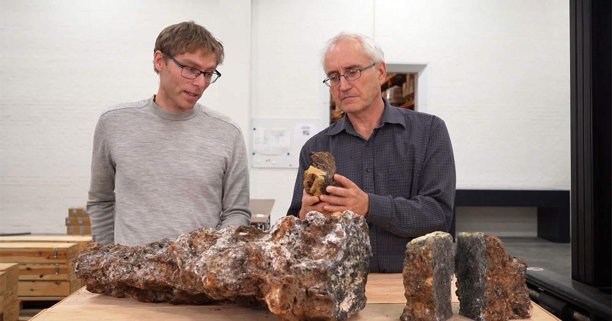
Nils Rune Sandstå and Jan Stenløkk, both geologists in the Norwegian Offshore Directorate, are displaying various samples of seabed minerals. (Image credit: NOD)
The Storting (Norwegian parliament) has given the go-ahead for opening parts of the Norwegian shelf for exploration and possible production of minerals.
In the years ahead, we need to acquire even more knowledge about these resources – and their surrounding environment.
“When the companies gain access, there are plenty of things they’ll have to figure out – but there’s also much that we already know. The Norwegian Offshore Directorate has mapped the areas in question, systematically, since 2017,” says Hilde Braut, who is responsible for seabed minerals in the Technology, analysis and coexistence department.
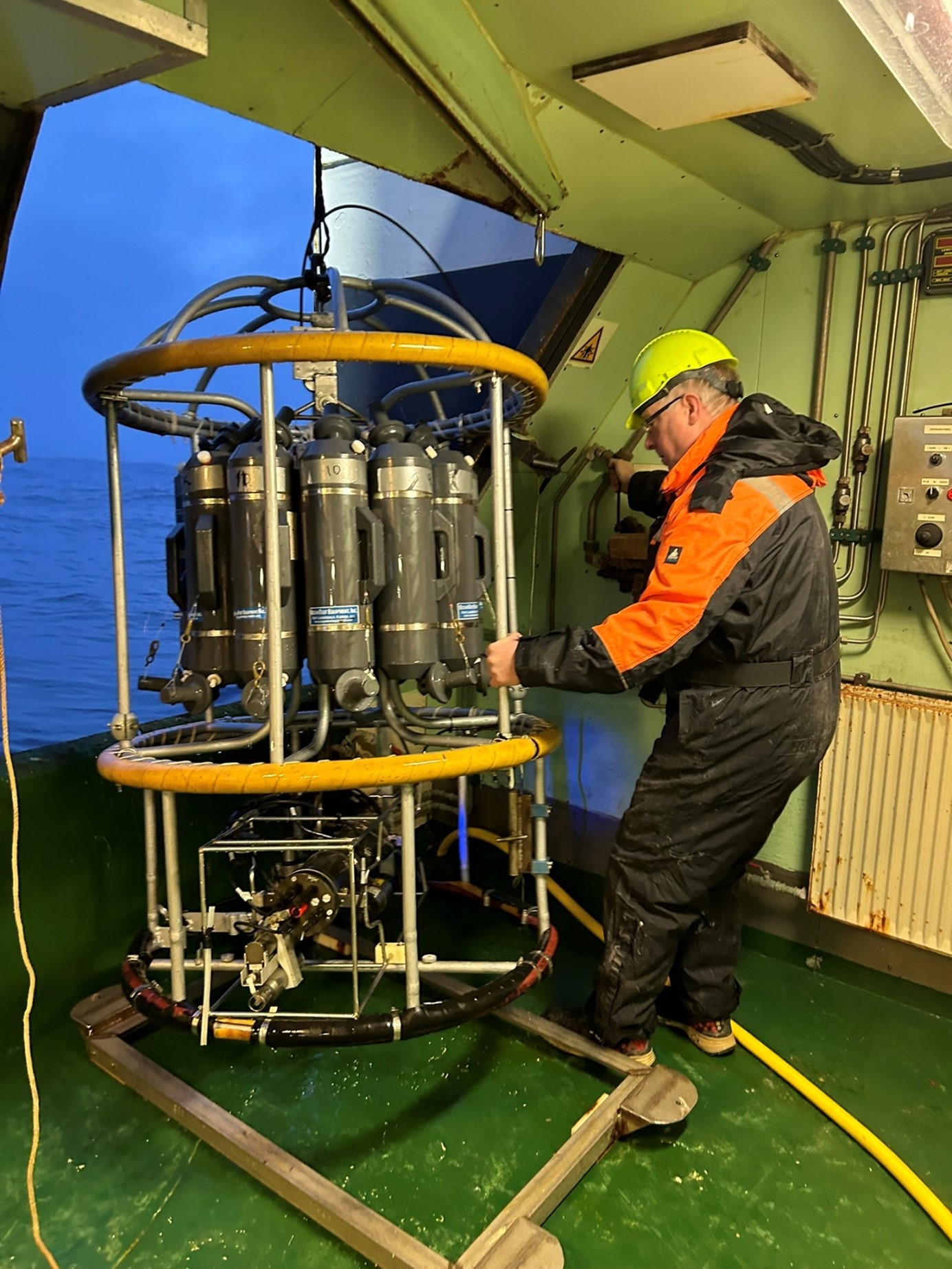
The photo is from one of the Norwegian Offshore Directorate’s expeditions in 2024, which took place in the Norwegian part of the Greenland Sea with the Helmer Hanssen vessel. The expedition included measurements of water temperature and salt content. It took a couple of hours to get the equipment up and down to 3200 meters. This could only be done when the sea was relatively calm. (Image credit: Harald Sund)
On behalf of the Ministry of Energy
In simple terms, the Norwegian Offshore Directorate is responsible for maintaining an overview of the resources both above and below the seabed. We’ve made projections regarding oil and gas all the way back to the early 1970s, and mapping minerals has been included in recent years.
So far, we’ve determined that there may be significant deposits of sulphides and manganese crusts on the Norwegian shelf. These are found in locations such as along older and current spreading ridges, as well as on ridges on abyssal plains several hundred nautical miles from shore. Water depths at these sites generally range from 3000-4000 meters. The reason for our focus on these deposits is because they contain interesting volumes of metallic elements.
Demand for these metallic elements is growing, as they are essential to the energy transition.
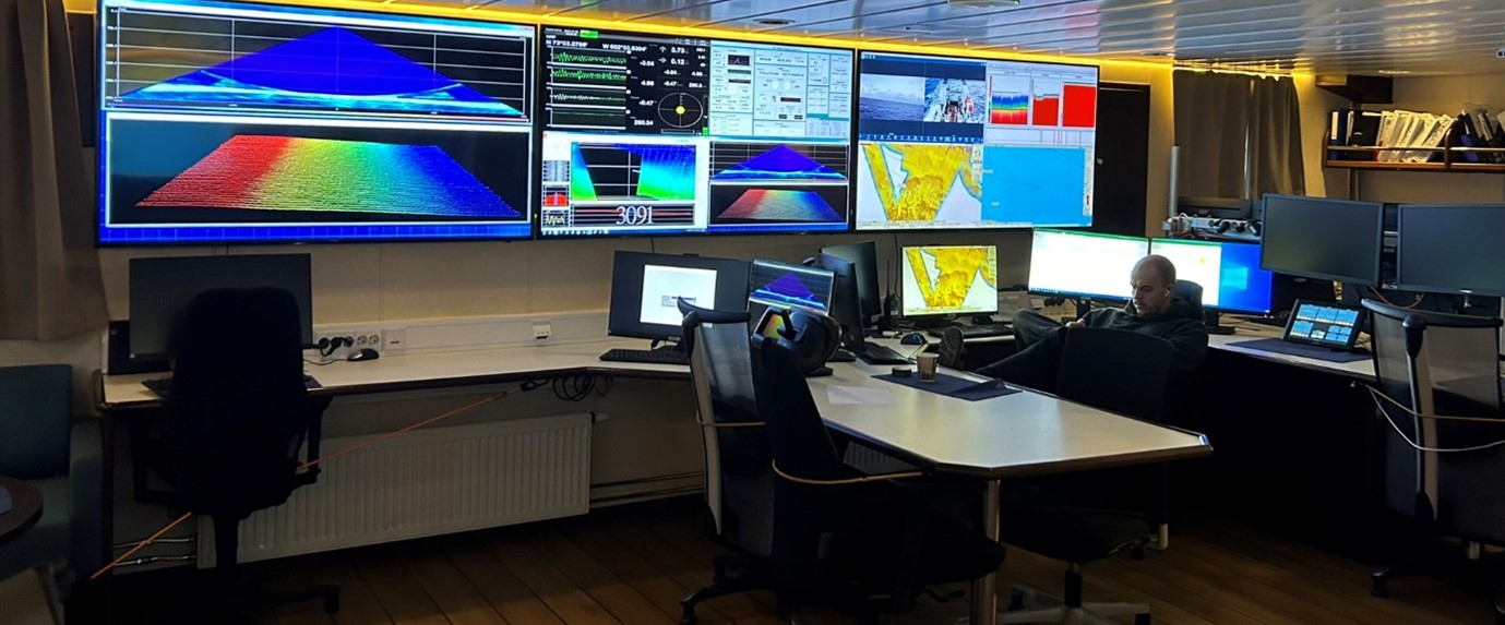
The work room on the Helmer Hanssen vessel. Stormer Alexander Jensen keeps an eye on the echo sounder. Navigation had to be adjusted as the underlying terrain became visible; some places were shallow (1450 meters) while other places were as deep as 3600 meters. (Image credit: Harald Sund)
How we conduct mapping
Mapping minerals in water depths of many thousands of meters is a painstaking endeavor. In recent years, we have conducted a number of expeditions with ships – both under our “own flag” and in cooperation with the academic community, first and foremost the University of Bergen and the University of Tromsø – the Arctic University of Norway. These expeditions can take weeks or even months.
“It’s a good thing to cooperate and share – researchers gain access to data and samples they can examine, while we benefit from their knowledge and expertise,” says geologist Nils Rune Sandstå.
An interesting area is typically surveyed in three rounds – but using different tools and with different purposes. The first step is to gain an overview of the seabed terrain. Using ships, the seabed is first mapped using multibeam echo sounders, which provides a map of these deep-sea landscapes with resolutions down to 20-50 meters.
The depth data we acquire from the ship mapping forms the basis for the next phase of exploration, which is conducted by AUVs (autonomous underwater vehicles). An AUV looks like a small torpedo fitted with several important sensors. It is released into the depths to conduct detailed mapping of the areas we want to examine more closely. The AUV moves around 50 to 70 meters over the seabed, automatically adjusting its path according to the terrain.
“We bring it back up after 40-45 hours, download the data, replace the battery – and then release it back down into the sea. The depth data from the AUV yields a seabed resolution of 1x1 meters,” says Sandstå.
The third step of the mapping is typically done with ROVs (remotely operated vehicles).
“The ROV allows us to get even closer to the seabed. It can be used for purposes such as taking physical samples, video and photos.”
Norwegian technology has been key in the development of AUVs and ROVs, and these tools are used in many different contexts, such as in the Norwegian Armed Forces and in the oil and gas industry.
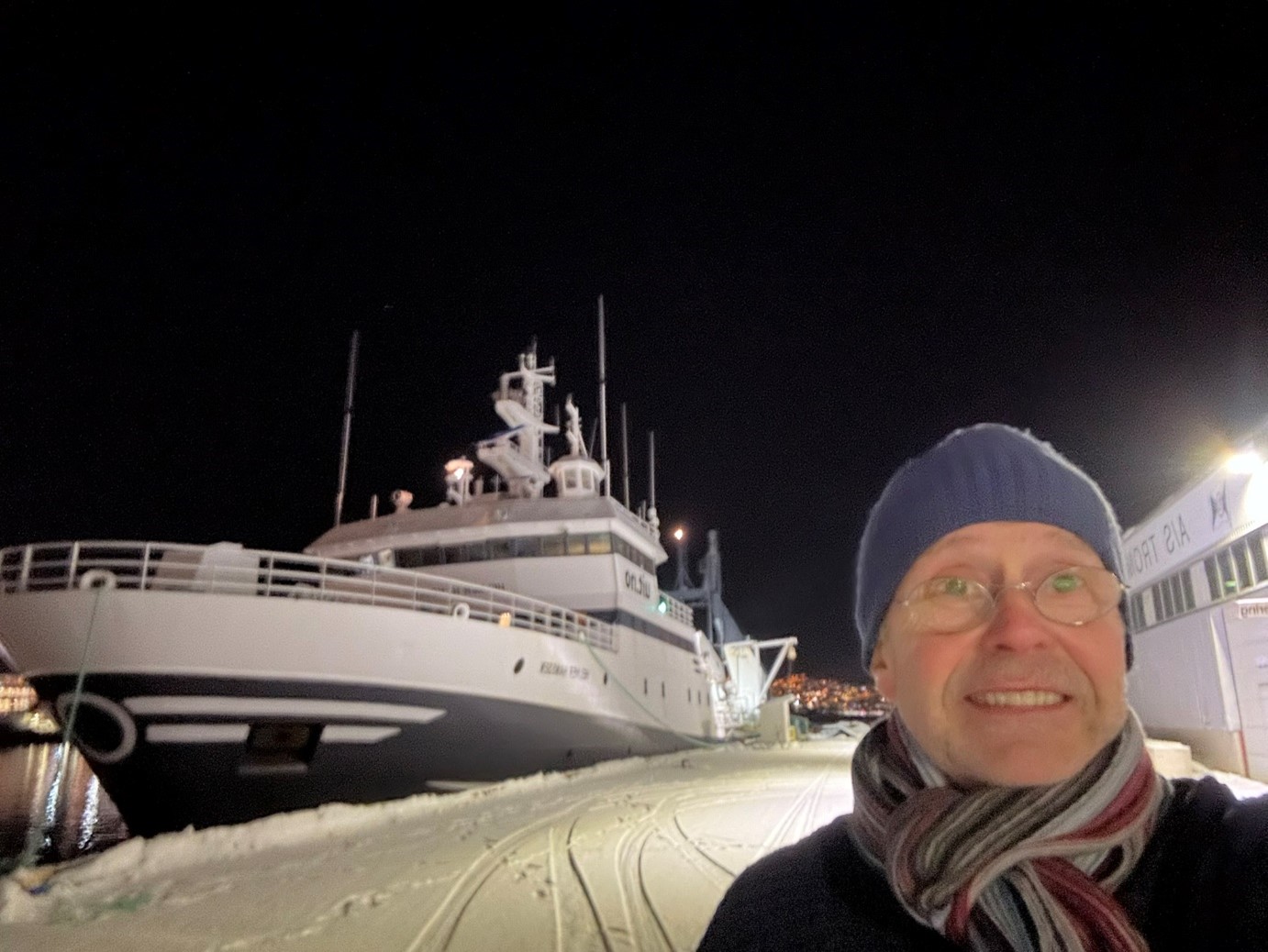
The Helmer Hanssen research vessel at quay in Tromsø in February 2024. On the right, geologist Harald Sund who was the Norwegian Offshore Directorate’s representative on the expedition in the Norwegian part of the Greenland Sea. (Image credit: Harald Sund)
Versatile technology
Bathymetry and data collected using AUVs and ROVs provide a good image of the seabed – but the mapping job is not complete:
“We know a lot about the areas we’ve mapped but we need more knowledge, including about the environment, before extraction could possibly become relevant,” says Hilde Braut.
She knows that the tools used to find out more about the minerals are also well-suited to map the environment:
“Using bathymetry, we can collect various types of water column data. We can also observe and take pictures of living organisms and stocks and obtain environmental data for the seabed itself.”
Whether the seabed terrain is formed by volcanic activity (basalt) or by sediments (soft-bed) tells us something about life and organisms.
“The Norwegian Offshore Directorate has mapped the relevant deepwater areas using the best-suited methods since 2017. This makes us well-equipped to continue our exploration and investigation, including with a focus on the environment,” says Braut.
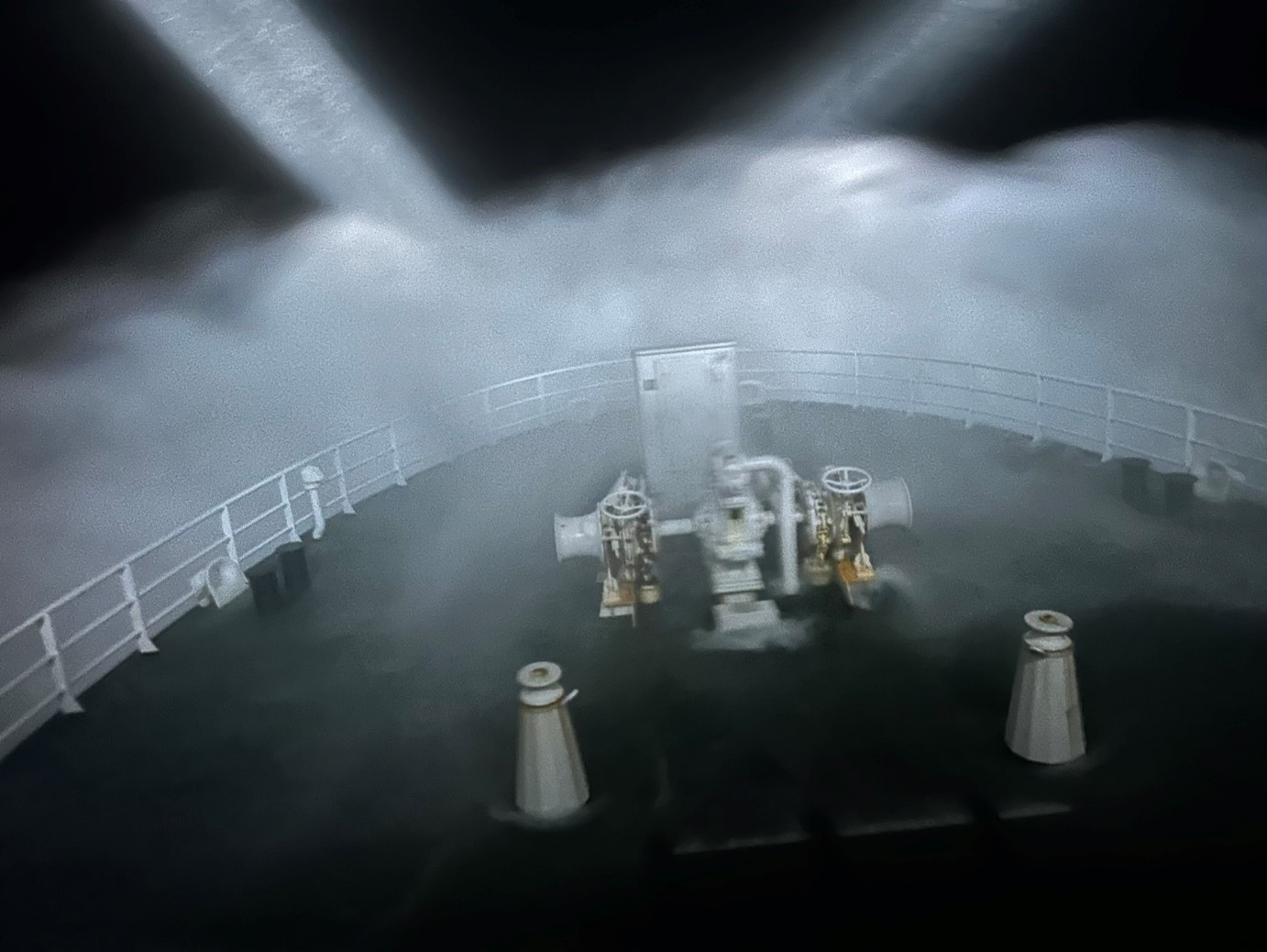
The Greenland Sea can be both dark and stormy in the winter. This photo is from one of the Norwegian Offshore Directorate’s expeditions in 2024. (Image credit: Harald Sund)
What now?
In January, the Storting endorsed the Government’s proposal to open parts of the Norwegian continental shelf for exploration for and production of minerals. The Storting White Paper Mineral Activities on the Norwegian Continental Shelf - Opening of Areas and Resource Management Strategy can be found here (in Norwegian only).
A final resolution will be processed through a Royal Decree.
If mineral activity on the seabed is given a green light, areas will be opened for exploration and production. In the initial phase, exploration licenses will be awarded before a potential discovery can be developed. If a development plan is submitted, it will have to include a project-specific impact assessment that must be approved by the Storting.
Interested companies will apply for licences, and the authorities will require the players who are allowed to explore to implement a specific work program with milestones. This is based on the practice applied in the petroleum activities.
“We know there are a handful of companies that may be interested,” says Hilde Braut.
The authorities’ own technical efforts will continue in parallel. The Norwegian Offshore Directorate will continue to map the resources, while Mareno will contribute in the work to map environmental data.
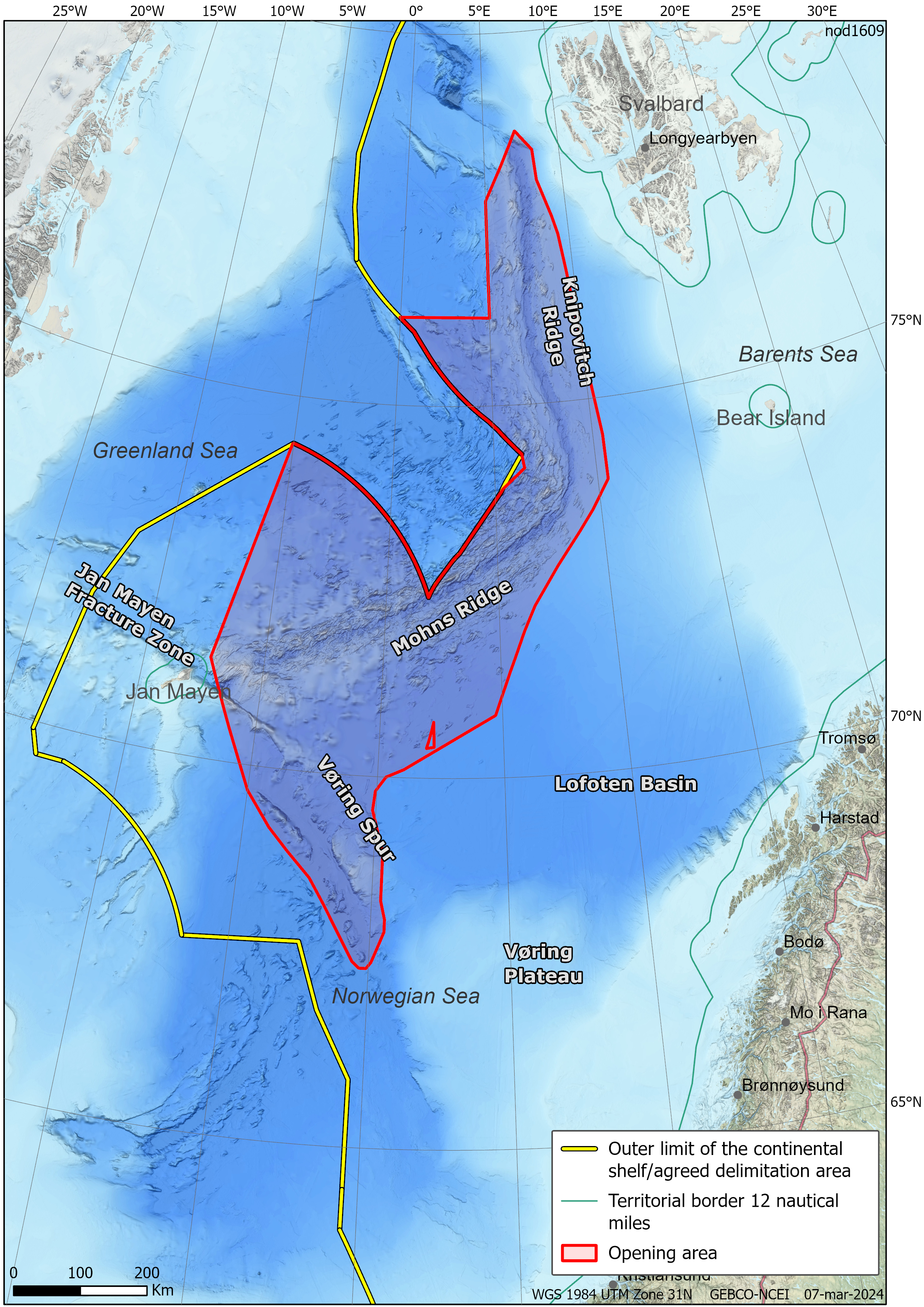
Map showing the opening area. (Image credit: NOD)