On the Way to a Complete Seafloor Map
ON&T
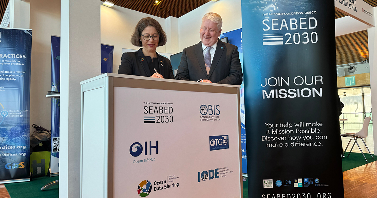
The common goal is a complete and freely accessible map of the entire seafloor by the end of this decade: GEOMAR Director Professor Dr. Katja Matthes and Jamie McMichael-Phillip, Director of the Nippon Foundation-GEBCO Seabed 2030 project sign the Memorandum of Understanding. (Image credit: Tobias Hahn, GEOMAR)
At the United Nations Conference for the Decade of the Ocean in Barcelona, GEOMAR Helmholtz Centre for Ocean Research Kiel and the Seabed 2030 project have signed a Memorandum of Understanding to jointly improve the mapping of the seabed. The collaboration aims to fill gaps in knowledge about the topography of the seafloor and create a comprehensive map of the ocean floor.
At least twice in the last 20 years, nuclear submarines have collided with previously unknown underwater mountains called seamounts. The reason: they were not on any nautical charts. Just last year, a study discovered 19,000 new, previously unknown seamounts. There are now around 43,000 known seamounts over 1,000 metres high. But most of them have never been mapped.
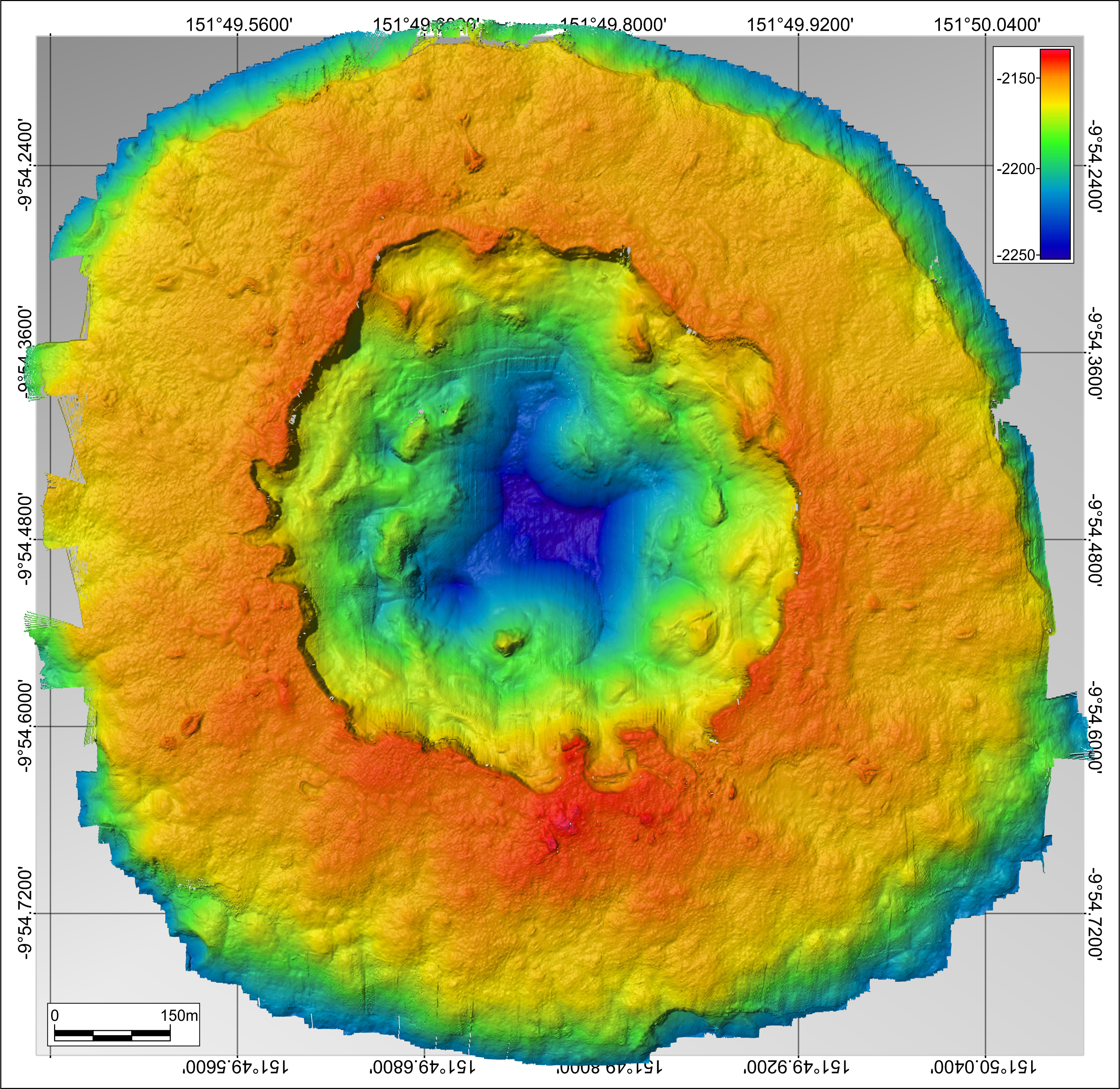
High-resolution mapping provides a better understanding of hydrothermal systems such as black smokers. Here, Franklin Seamount in the Pacific, imaged by an autonomous underwater vehicle (AUV), ABYSS. (Image credit: Nico Augustin, GEOMAR)
Mapping the topographic shape of the seafloor is called bathymetry (from the Greek words bathýsdeep and métron measure). And there are still many gaps in the bathymetric maps of the world's oceans. The example above dramatically illustrates the need for accurate underwater maps. But it is also essential for understanding ocean circulation and climate models, for assessing geohazards such as submarine slides on oceanic island flanks, for exploring seabed resources, and for marine spatial planning, including the delineation of marine protected areas.
Only about 25% of the seafloor has been mapped using ship-borne echosounders, which is the only method capable of producing high-resolution (10m) seafloor maps. Another survey method is satellite altimetry, which infers seafloor topography from satellite measurements of deviations in the sea surface. This provides global coverage, but with a much lower resolution of several kilometers, allowing only large-scale structures to be identified. As Professor Dr. Lars Rüpke, head of the Seafloor Modeling Group at the GEOMAR Helmholtz Centre for Ocean Research Kiel, explains, “ship-based echosounder surveys remain indispensable” for more detailed seafloor mapping. Currently the group is campaigning for a closer integration of underway data with urgent research questions. Rüpke: “For example, data collected during transits by German research vessels can be used to systematically map seamounts.”
“Our vision is to have a complete and freely accessible map of the entire seafloor," says Dr. Rüpke. "We share this vision with the many researchers from all over the world who are involved in the Seabed 2030 project". As part of the United Nations Conference on the Decade of the Ocean, which starts today in Barcelona, GEOMAR and Seabed 2030 have now signed a Memorandum of Understanding (MoU) to work together to improve seabed mapping.
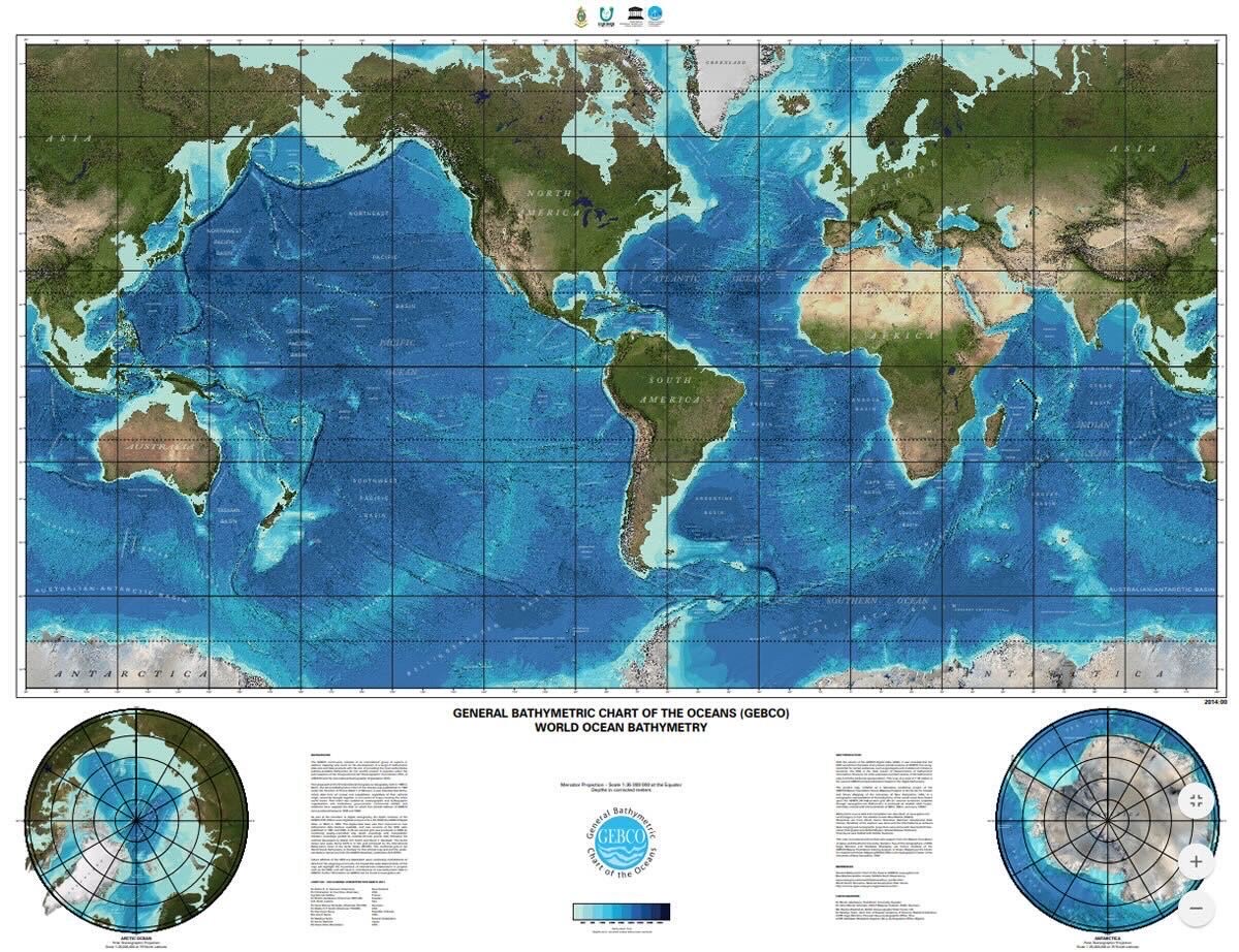
The GEBCO world map shows the known bathymetry of the global seabed in the form of a shaded relief color map. The imagery is based on the 2022 version of the global GEBCO grid. (Image credit: The Nippon Foundation-GEBCO Seabed 2030 project)
Professor Dr. Katja Matthes, Director of the GEOMAR Helmholtz Centre for Ocean Research Kiel, said: “The international availability of collected data is the basis for successful cooperation and a decisive step towards a global map of the seafloor. The signing of this Memorandum of Understanding with Seabed 2030 shows the enormous potential to jointly pursue the goal of the UN Decade of the Oceans ‘to protect and sustainably use the oceans and marine resources for sustainable development’. The international networking of GEOMAR's expertise with the global Seabed 2030 initiative is a further milestone in international marine research.”
Jamie McMichael-Phillips, Director of Seabed 2030, stated: “I am absolutely delighted that we have partnered with GEOMAR, a world leading institution in marine research. Our MoU reinforces the strong links with their extensive science team and the combined GEOMAR/German research fleet which has global reach. This will undoubtedly strengthen the SB2030 global ocean mapping community, driving us forward in supporting the GEBCO mission.”