Artificial Intelligence—from Research to Application
Ocean News
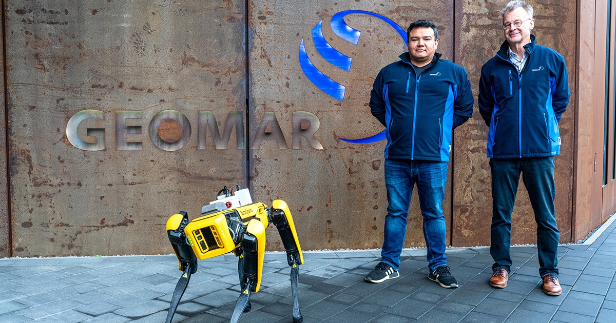
The SPOT robot dog is equipped with a highly sensitive multi-gas sensor originally developed by Roberto Benavides (left) for underwater applications. The project was initiated by Warner Brückmann (right), who had the idea of combining robotics, sensors and AI for safety applications. (Image credit: Sarah Kaehlert/GEOMAR)
Using artificial intelligence (AI), researchers at the GEOMAR Helmholtz Centre for Ocean Research in Kiel are working together with local companies to develop future technologies for marine research and the safety of industrial plants.
For this application-oriented research, Dirk Schrödter, Minister for Digitalization and Head of the State Chancellery of Schleswig-Holstein, has now awarded two grants totaling around 1.3 million euros in accordance with the AI Directive of the State of Schleswig-Holstein.
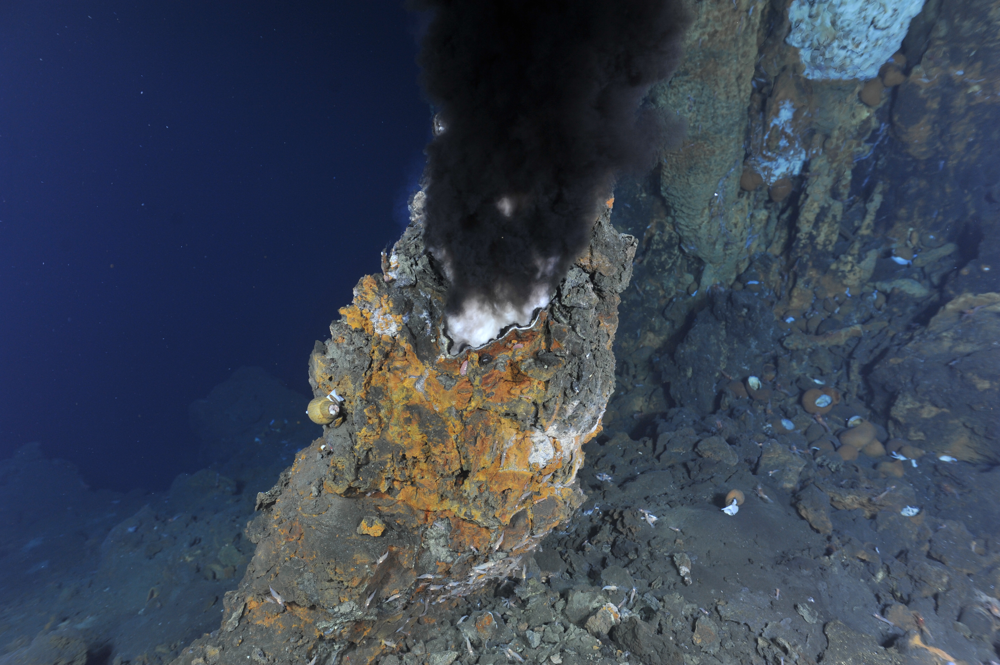 Black smokers, such as this one at Niua volcano in the Lau Basin of the Western Pacific, provide unique habitats. These are still largely unexplored, but economic interests make human intervention in the deep sea likely in the future. (Image credit: ROV Team/GEOMAR)
"The oceans and the air on our planet are essential for life. It is particularly important that these sensitive habitats are protected, researched and monitored," said Digitalization Minister Dirk Schrödter.
"The two funded projects - mapping the seabed and identifying harmful gases in the air - are therefore of great importance to society. They are also prime examples of AI expertise, the spirit of innovation and the excellent interaction between business and science in Schleswig-Holstein."
"I am very pleased that our excellent research is being directly applied through projects such as KIMERA and SPOT-KI," said Professor Dr Katja Matthes, Director of GEOMAR. "The transfer of our research results into practical applications is one of our core tasks. For us at GEOMAR, this funding is an important signal that our research is actively contributing to solving current societal challenges".
Underwater vehicles such as the KIEL 6000 ROV can be used for detailed investigations Underwater vehicles such as the KIEL 6000 ROV can be used for detailed investigations of the deep-sea habitat and its resources. Their use is only possible if the sea floor has previously been mapped by ship using a multibeam echosounder. So far, less than twenty-five percent of the deep seafloor has been mapped in this way.
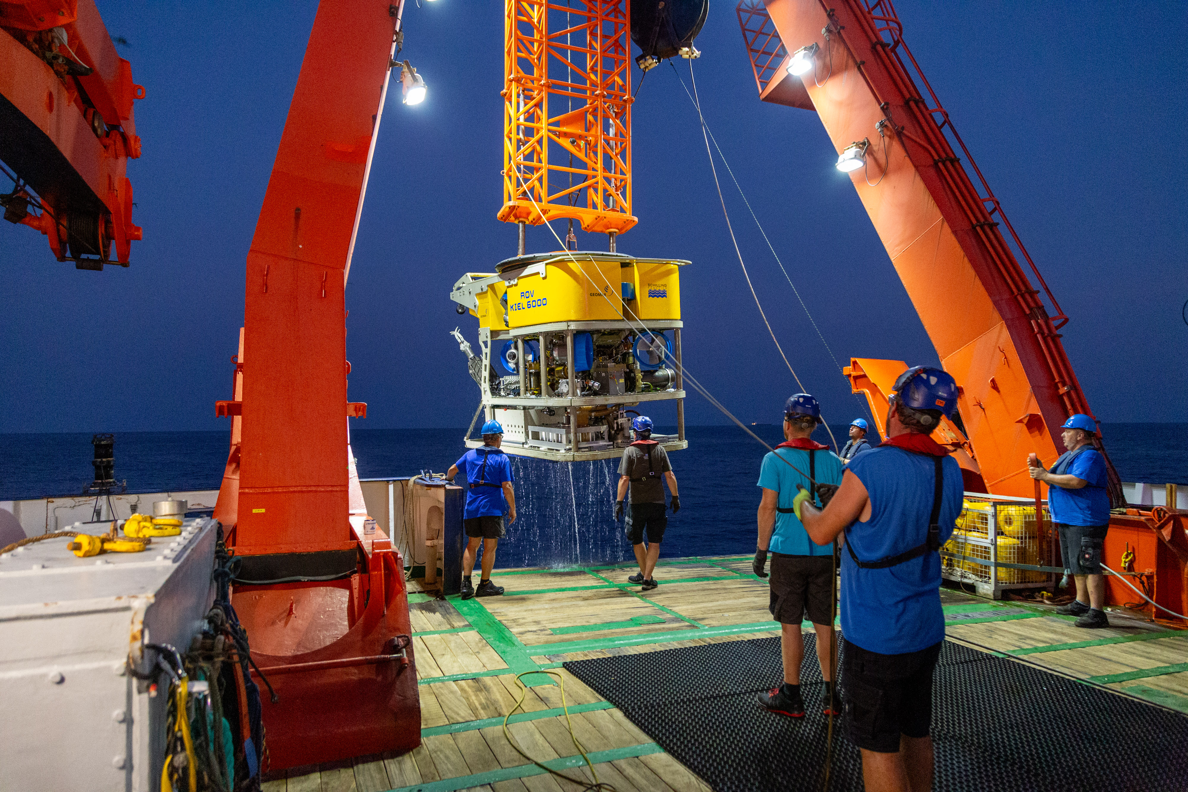 (Image credit: David Diekrup/GEOMAR)
SPOT-KI: A robot sniffer dog
The close monitoring of industrial plants with the help of autonomous robot dogs from Boston Dynamics is already a standard application. However, the SPOT-KI project takes this a step further. First, the SPOT robot dog has been equipped with a highly sensitive multi-gas sensor originally developed by Roberto Benavides and his team at GEOMAR for underwater applications. This allows up to 64 gases to be detected simultaneously in the air, even at the lowest concentrations (1 ppb). Secondly, SPOT will be augmented with AI that allows it to compare a digital twin of the plant with its current perception. As a result, not only can it detect and report changes in its environment, but it can also immediately begin to search for possible leaks if the gas composition changes. In effect, SPOT becomes a sniffer dog that uses AI processes to actively search for the source of a gas measurement. SPOT-KI is a joint project between GEOMAR and Northdocks GmbH (a spin-off of the University of Kiel). The state of Schleswig-Holstein is providing 610,000 euros for the development of this mobile multi-gas monitoring system.
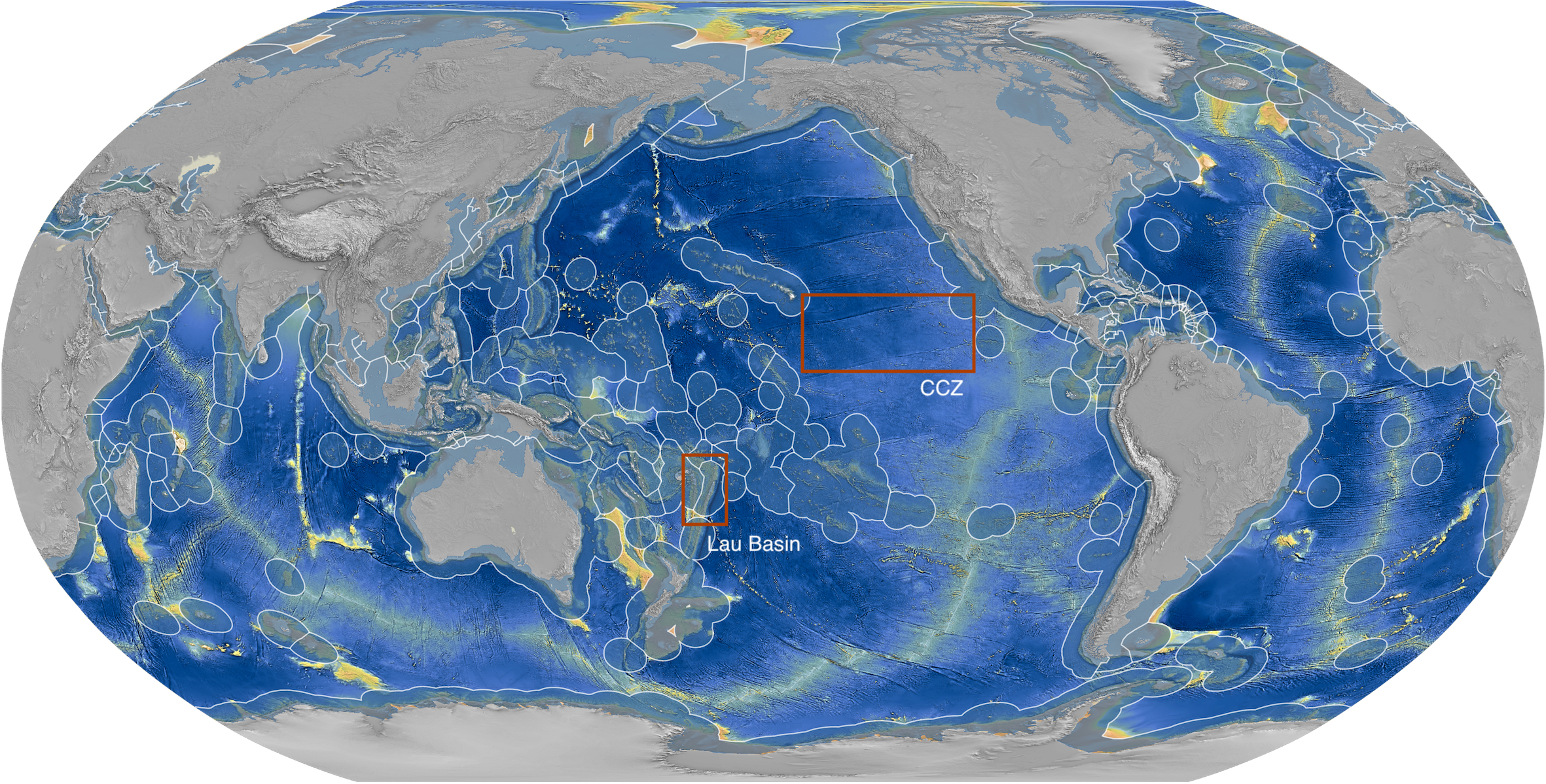 Using ship-based mapping, an AI will be trained in the geological classification of the seafloor and its habitats in two pilot areas, the Clarion-Clipperton Zone in the Eastern Pacific and the Lau Basin between the island states of Fiji and Tonga. (Image credit: Sven Petersen/GEOMAR)
KIMERA: Classifying the seabed to protect the deep sea
The second collaborative project, KIMERA, will receive €683,000 to develop artificial intelligence for seabed mapping and marine spatial planning. The deep sea, the largest ecosystem on Earth, is largely unexplored. Less than twenty percent of the deep seabed has been mapped. However, growing economic interest in resources such as iron manganese nodules means that human intervention in this still largely untouched and particularly vulnerable ecosystem is likely to increase. Knowledge of the nature of the seabed and the habitats that require protection is needed to designate meaningful protected areas and license areas for exploitation. However, this knowledge is currently patchy at best. One possible solution is to use AI to automatically classify the seabed. The result would be predictive maps that could be used to estimate both resource deposits and the probability of finding certain habitats. To this end, an AI will be trained using existing manually generated maps of the seafloor. To this end, scientists from the GEOMAR Marine Mineral Resources research group, led by Dr Philipp Brandl, are collaborating with the Kiel-based geodata specialist north.io GmbH, which specializes in processing large amounts of marine data and AI applications.
Technology transfer and industrial cooperation at GEOMAR:
The department of research promotion and transfer at GEOMAR supports partners from industry, science and society in the search for suitable cooperation opportunities for their projects and in the joint development and application of innovative research results from GEOMAR.