Papua New Guinea is a 250 Million-Year-Old Queenslander
Ocean News
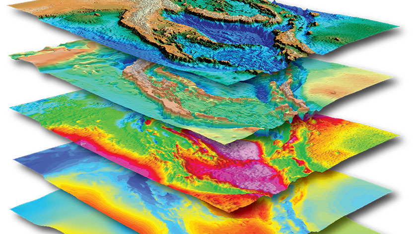
Papua New Guinea SEEBASE 3D stack of data and interpreted layer
Findings in a new geological study conclude that much of Papua New Guinea formed on the eastern margin of Queensland, not adjacent to northern Australia as previously thought.
The Papua New Guinea SEEBASE® multi-client Study and GIS by Frogtech Geoscience considers the geological origins of Papua New Guinea dating back 250 million years. The study concludes that a large portion of the island’s land mass began the long journey to its current position from somewhere between Charters Towers and Rockhampton on Australia’s eastern seaboard.
The study’s lead author, Dr. Rob Holm, explains: “By looking at sediments that were deposited 100 or 200 million years ago, we can look at potential sources for those sediments. In this case, the sediments could not possibly have come from northern Australia as previous studies have inferred.”
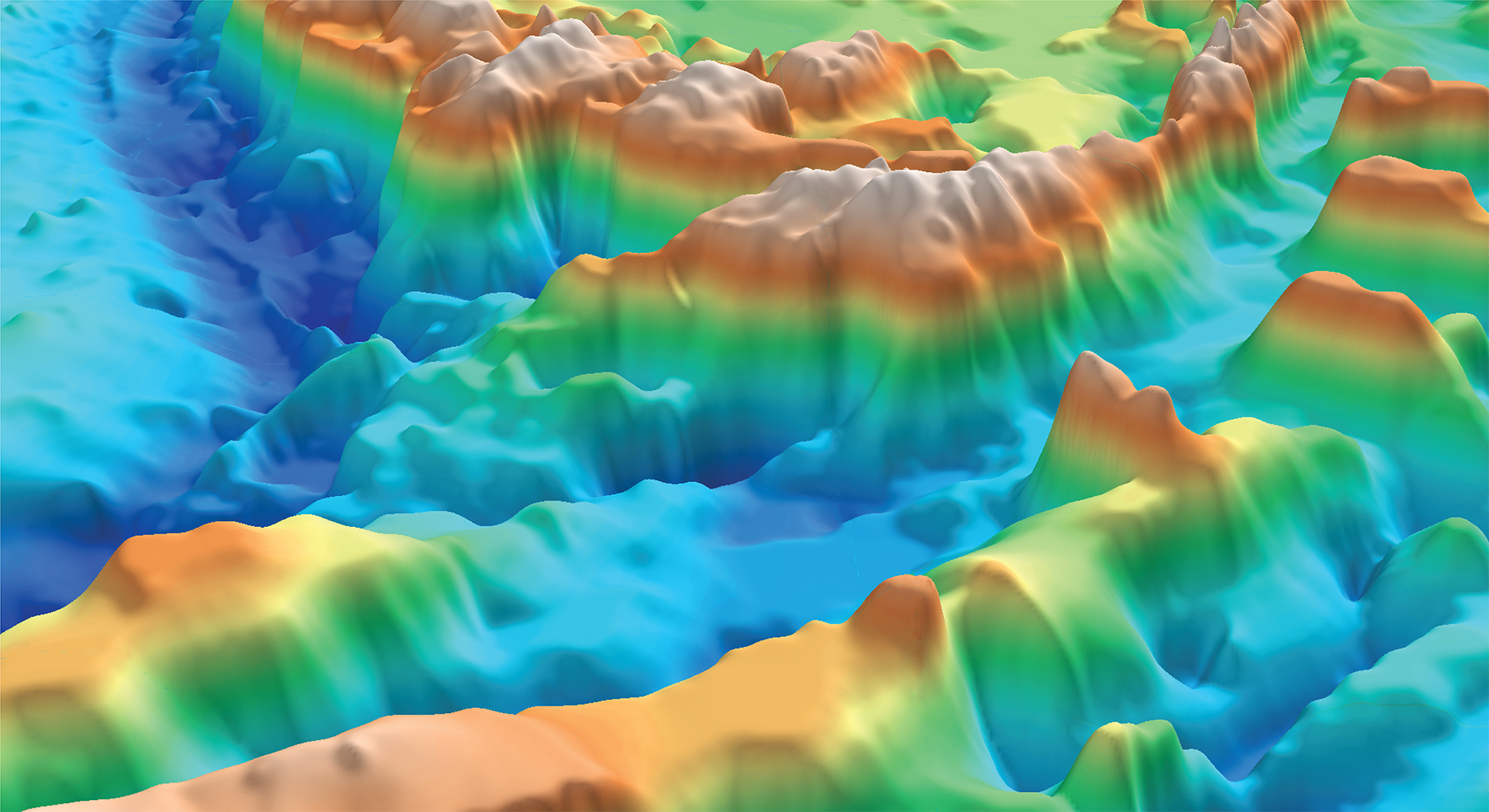 Oblique 3D SEEBASE image of subduction zones and intrusive arc basement in PNG
The new study tracks the geological blocks from formation on the Queensland coast, through their 100-million-year long journey wrought with volcanism and terrane collision events, to their final destination at the northern continental margin of Australia which culminated in construction of the New Guinea Highlands.
Frogtech CEO, Ryan Murphy, highlights the worth of the study. “The Papua New Guinea SEEBASE® Study is a game changer for our understanding of the tectonic evolution of Papua New Guinea. Frogtech’s uniquely valuable interpretations shed new light on the formation of the region and its resources, which in turn opens up exciting opportunities for future exploration.”
The Papua New Guinea SEEBASE® multi-client Study and GIS is an integrated geophysical and geological study of basement and basin evolution of Papua New Guinea. The study uncovers the elusive geological past of the region and strips back the layers of the Earth to reveal the first continuous 3D depth-to-basement interpretation of the country. This interpretation framework can accommodate integration of proprietary client datasets including higher-resolution gravity and magnetic data, well data, and seismic interpretation to further customise the model in areas of interest.
For more information on the Papua New Guinea SEEBASE® Study, click here.