SWOT Analysis: A Sea Change for Modern-Day Oceanography
Ocean News
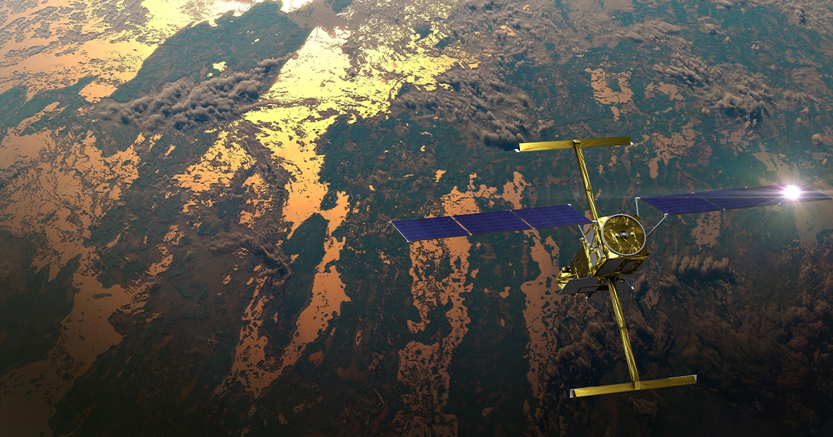
This illustration shows the SWOT satellite in orbit with sunlight glinting off one array of solar panels, as well as both KaRIn instrument antennas deployed. (Image credit: CNES)
Back in mid-December 2022, a mission led by NASA and the French space agency Centre National d'Études Spatiales (CNES) launched the Surface Water and Ocean Topography (SWOT) satellite into space, from where it will observe huge swathes of ocean and surface water in unprecedented detail.
The SWOT satellite’s Ka-band Radar Interferometer (KaRIn) instrument is engineered to measure the height of water found on Earth, in lakes, rivers, and oceans. Until now, researchers wishing to study a body of water relied on instruments that measure at specific locations—like gauges in rivers or the ocean—or that are space-based, gathering data along narrow “tracks” of the Earth seen from orbit. From there, researchers extrapolate the data to gather a broader idea of what’s happening in any given body of water.
However, KaRIn represents something of a sea change. The radar instrument uses the Ka-band frequency at the microwave end of the electromagnetic spectrum to penetrate cloud cover and the dark of night, meaning it can take measurements regardless of weather or time of day. By bouncing radar pulses off the water’s surface and receiving the return signal with two antennas—mounted at the ends of a 10-meter-long boom—KaRIn will collect data along a swath 50 kilometers wide on either side of the satellite.
ENGINEERING FEATS
The team at NASA's Jet Propulsion Laboratory has spent years developing the KaRIn instrument and had to overcome a series of operational challenges, in particular the need to ensure the sufficient stability and precise tilt of the satellite, the solution to which involved the incorporation of a high-performance gyroscope to account for any shifts in SWOT’s orbital positioning.
The amount of transmitted radar power needed to measure surface features down to centimeter accuracy—pulses of 1.5 kilowatts, a huge amount of power for a satellite like this—was also another engineering hurdle. Ultimately, this meant fabricating and incorporating materials specific to high-voltage systems to enable SWOT’s electronics system to handle thousands of volts at any one time.
The net result, and the product of years of conceptual design, technology development, testing, and validation, is a satellite set to revolutionize modern oceanography thanks to its capacity to detect ocean features with 10 times better resolution than present technologies.
CRITICAL DATA
The higher resolution will allow oceanographers to better observe small-scale ocean features that contribute to the ocean-atmosphere exchange of heat and carbon—major components in global climate change—as well as providing highly detailed information on ocean circulation and the dispersion of life-sustaining nutrients and harmful pollutants.
Scientific breakthroughs will include a clearer understanding of sub-mesoscale eddies, short-lived, swirling ocean currents that are thought to be responsible for transporting half of the heat and carbon from the upper ocean to deeper layers, so are critical actors in the global climate shifts. SWOT will also reveal new details about the transport of many ocean-based nutrients—essential to the healthy balance of the marine food web and the productivity of fisheries—as well as a raft of other fine-scale pollutants such as crude oil, harmful river discharge, and debris (e.g., from extreme weather events). All these variables, alongside other SWOT data, will prove instrumental in refining ocean circulation forecasts, predictive models that help optimize offshore commercial operations and coastal planning activities.
TECHNICAL COLLABORATION
The SWOT mission is a truly collaborative effort, uniting an international cast of oceanographers and hydrologists, and while the project is jointly led by NASA and Centre National D'Etudes Spatiales (CNES), significant contributions have been made from the Canadian Space Agency (CSA) and United Kingdom Space Agency. (This science instrument was provided by NASA's Jet Propulsion Laboratory; CNES and Thales Alenia Space built the radio-frequency subsystem; The Canadian Space Agency contributed the extended interaction klystrons; the Duplexer, a high-power switching system that is part of the radio-frequency unit, was funded by the UK Space Agency at Honeywell UK.)
One of the long-term goals of SWOT is to democratize valuable data that shapes meaningful decisions.
NASA's Applied Sciences Program are partnering with the SWOT project team to implement a strategy that promotes applications research and engages a broad community of users in the uses of SWOT data. The aim is to continue to integrate this community and encourage members to utilize science and data products in addressing broader societal issues and needs.
Speaking exclusively to ON&T, ENTER SPOKESPERSON, reflected on how pivotal this moment is for the study of our planet’s oceans:
“Now, as we move through the implementation stage of SWOT’s lifecycle, we will begin to see just how revealing detailed images of water levels and circulation are to the precise study of the patterns and shifts in the complex processes that govern the ocean and inland waters. Not only will these data unlock new scientific discoveries, but it will give us the validated information with which to make vital decisions about how best to manage one of the planet’s most precious natural resources.”
This story was originally featured in ON&T Magazine's January/February 2023 issue. Click here to read more.