SeaTrac USV Proves Instrumental to Collaborate Shallow Mapping Campaign in GOM & Tampa Bay
SeaTrac
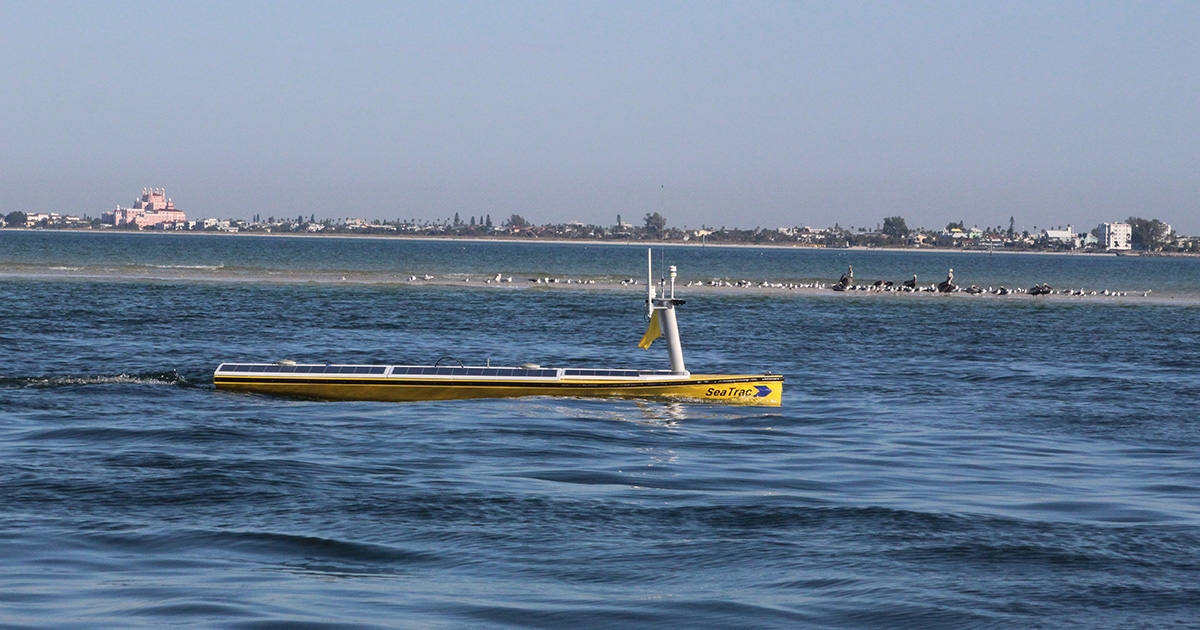
SeaTrac SP-48 on survey mission. (Photo credit: SeaTrac)
More than 50 percent of our nation’s Exclusive Economic Zone (EEZ) remains unmapped, and experts say new approaches are needed. “Coastal areas may be the easiest to get to, but they are the hardest to survey from large ships that have depth limitations and may be less nimble than smaller craft,” according to Steve Murawski, who heads the Center for Ocean Mapping and Innovative Technologies (COMIT) at the University of South Florida’s College of Marine Science (USF CMS).
AN ORCHESTRA OF TECHNOLOGIES
To this end, Murawski and a team of scientists from COMIT are presently conducting a novel hydrographic survey and mapping mission that combines SeaTrac’s solar-powered uncrewed surface vehicle (USV) equipped with a NORBIT iWBMSh-N multibeam sonar system, and Fugro’s airplane-mounted lightweight laser survey technology called a Rapid Airborne Multibeam Mapping System (RAMMS). Each technology has its place in a 90-square-mile test area that exhibits an array of conditions with differences in depth, water clarity, boat traffic and habitat types. The survey data will be used to improve storm surge modeling and prediction, maritime safety, fisheries management and more.
HIGH-QUALITY DATA
After three weeks of survey, the high-resolution hydrographic and bathymetric data acquired by SeaTrac’s 4.8-meter solar powered SP-48 yielded valuable insights, not to mention a surprise or two (e.g., several previously undiscovered small boat wrecks). “The vehicle has performed admirably, even under some challenging conditions,” said Matt Hommeyer, Technical Operations Manager at COMIT. v
“Getting a high-quality mapping sensor on a platform that’s small, nimble, and—most importantly—quiet is absolutely key for a shallow water survey like this one. That’s allowed us to collect very good data despite being in some tight areas where a traditional inshore survey vessel would not be comfortable at all,” added Hommeyer.v
"COMIT and its partners have achieved a significant milestone in advancing USV technologies with this mission,” said Neil Weston, chief scientist in NOAA’s Office of Coast Survey. “Our office is particularly interested in the outcomes from these field trials, especially when new technology approaches can improve our national priorities such as shallow water mapping, coastal resilience and emergency response."
ENGINEERED TO BE VERSATILE
SeaTrac’s highly configurable USV is designed to host an extensive range of sensors—including but not limited to sonars, lidar, sub-bottom profilers, USBL/LBL, INS, ADCP, and water quality sensors—and other custom payload modules for a wide variety of commercial, defense and scientific applications. The SP-48 can support a total payload of up to 70 kg (150 lbs), drawing up to 500 W for day-long missions, or approximately 25 to 85 W for 24x7 operation (depending on specified cruise speed and solar energy resources available), making it the ideal platform for marine research, monitoring, or surveillance tasks where autonomy, cost, and ease of deployment matter.
For more information, visit www.seatrac.com.
This story was originally featured in ON&T Magazine's January 2022 issue. Click here to read more.