Datawatch: How Analytics is Helping us to Explore Earth’s Final Frontier
Nitin Aggarwal
Nitin Aggarwal, Vice President of Analytics and Data Science for The Smart Cube
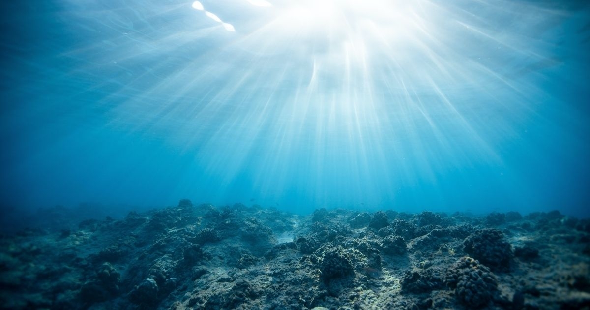
As deep as 11km in some places and covering more than 70% of the globe, the ocean is often called Earth’s final frontier: a vast, unexplored expanse full of unknowns and an environment that has huge repercussions on the rest of the planet.
The Mariana Trench, the deepest known point in our sea floor, is big enough to contain Mount Everest with a mile or so to spare. So it should come as no surprise that exploring these environments poses significant challenges. And that’s before you consider the impenetrable dark, the plunging temperatures, and huge hydrostatic pressure.
However, if there’s one thing, we’ve learned from our Data watch series it’s that human nature implores us to find answers to unknowns. Attempts to explore ‘Hadal depths’ – named after the Greek god of the underworld, Hades – have been documented since 1873, and have showed little sign of slowing since. And today, we have tools and techniques that can help us gain new insights into some of the ocean’s biggest mysteries.
 A race to map the ocean floor
Much like the land above it, the ocean floor is a topographical wonder, with vast mountains, canyons, channels, plains, trenches, and everything in between. As things currently stand, more than 80% of this environment remains unmapped and unexplored. But, with a bit of luck, that won’t be the case for much longer.
The race to map the ocean floor has been ongoing since 2017, in an effort to preserve an ecosystem the UN Environment Programme revealed as being in immediate jeopardy just a year prior.
Today, the international Seabed 2030 Project is striving to map all of the world’s bathymetric data (the measurement of the depth of water in oceans, rivers, or lakes) to make a definitive map of the ocean floor available to everyone by 2030.
Once completed, this map will be used for vital analytics work, providing insights into everything from where best to lay fiber optic cables to how sea levels are changing. And, importantly, the impact human activity has on underwater habitats.
Companies like DeepSea Numerical are conducting similar work, recording changes in underwater environments to create an actionable dataset for analysts. The company has produced a cloud-based analytics platform that provides real-time monitoring and modelling capabilities used to identify contamination sources. The platform includes a variety of indicators, including weather, environmental, temperature, and salinity data to provide insights into changing conditions.
Similarly, the Environmental Defense Fund uses a network of underwater sensors in its work to create a vital underwater observatory, in an attempt to “revitalize our oceans to support marine life and the billions of people who depend on it”.
For most of us, what happens in the ocean can seem like a distant problem. But not only does it provide a vital source of food for many around the world, it also contributes trillions to our economy and supports the livelihoods of millions of people.
The quicker these projects can help us understand this environment, the faster we can start implementing the best strategies to ensure it’s protected.
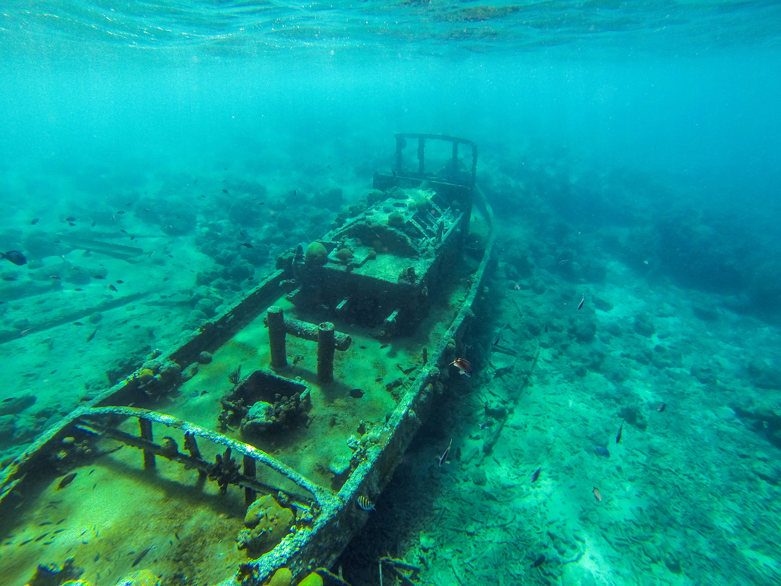 Uncovering wrecks lost to time
A lot of what lies below the surface of our oceans is a mystery, but there are some things that we know are there – somewhere. Over the years, thousands of ships, planes, and other vessels have been lost to the seas, and analytics plays a huge part in helping us find them.
On 3rd September 1857, the SS Central America set sail from Panama to New York carrying a cargo of millions of dollars’ worth of gold. A week into its journey, bad weather caused the ship to sink thousands of meters below the surface. It stayed there unlocated until 1988, when a data analyst, mathematician, and pioneer of Bayesian search theory joined the hunt.
Armed with the data from hundreds of eyewitness accounts, Larry Stone used computer simulations to create a search area of around 1,400 square miles, divided into two-square-mile grid references. He then used Bayes’ theorem, which establishes the probability that something is true by categorizing evidence based on its strength, to search the most likely areas. These results were further refined based on each new piece of evidence the search uncovered.
Just like that, a mystery that had lasted more than a hundred years was solved when the SS Central America was found – along with nearly $50 million in gold.
More recently, geographic information system experts Esri have been using a combination of GIS maps and bathymetric data to gain insight into where shipwrecks lie in Jamaica Bay, NY.
As these technologies continue to advance, we can expect more of the ocean’s hidden secrets to be uncovered.
Monitoring sea life
As our way of life increasingly encroaches on marine environments, whether through renewable energy initiatives or overfishing, understanding how our actions impact sea life is vital to ensuring we make the best decisions for our planet.
Today, several initiatives are using data and analytics to help us gain new insights into life beneath the waves.
In 2018, a team at the University of Washington created a ‘mechanical eye’ designed to monitor the behavior of marine life near renewable energy sites. The Adaptable Monitoring Package (AMP) uses photographs and a variety of sensors, like echosounders, to monitor the behavior of schools of fish and other sea creatures near renewable energy infrastructures.
By conducting analytics on this data, the group strives to create a clearer picture of the risks of marine energy and establish how it can be used more sustainably in the future.
In a similar project, a Washington-based team has been investigating the effect whale-watching vessels have on the ability of whales to forage for food. The project tested variables including the number of vessels, their speed and distance, and the sex of the whales, to discover that orcas made fewer dives for food when vessels were within 400 yards.
These findings can now be used to change the behaviors of whale-watching companies and ensure their movements don’t impact on the survival of endangered species.
Close the beach!
We can all agree there are some things in the sea that we’re quite happy not to know about. Especially those of us old enough to have seen Steven Spielberg’s Jaws as children.
However, far from shying away from the issue of shark attacks, the Florida Museum has been collating data in its International Shark Attack File (ISAF) for a number of years. The file currently contains information on more than 6,500 incidents.
Recently, the museum has conducted some analysis on this data to assess the likelihood of a shark bite being fatal. You can explore this work in detail, from the cleaning of the data through to the initial results, here.
But be prepared, it may put you off swimming for a while.
Fighting climate change
Many people don’t know that the ocean is the Earth’s primary sustained carbon sink, and has been mitigating the effects of climate change since the Industrial Era. In fact, 35 times more CO2 is thought to be absorbed by seagrass than by rainforests.
However, as a series of talks at this year’s COP26 summit revealed, ocean degradation has made this situation increasingly uncertain.
This is yet another reason that protecting our oceans is paramount, and analytics will play a huge role in helping us to do that. From simulating interventions and approaches to carbon dioxide removal, to tracking climate change and human impacts, data science holds the answers we need to ensure our actions are sustainable and have a positive effect on our environment.
One notable example is a new study from the Indian Institute of Information Technology, which is helping to build awareness on plastic pollution. The project strives to track the 8 million tons of plastic that end up in the ocean every year – and uses data from Malaysian Airlines Flight 370 to validate its findings.