New Deep Sea Mineral Deposits Found in the Norwegian Sea
Ocean News
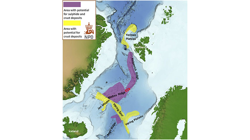
Mapping area (red square) in the central part of the Mohn ridge in the Norwegian Sea. The map also shows potential areas for seabed minerals such as sulphides and crusts. Credit: The Norwegian Petroleum Directorate
The Norwegian Petroleum Directorate just concluded a successful three-week data acquisition expedition on the Mohn’s ridge in the western part of the Norwegian Sea.
The Mohn’s ridge is a seafloor spreading ridge, separating two oceanic plates, and the objective of the expedition was to investigate the possible existence of mineral resource deposits in this area. The NPD has identified a large area of sulphide minerals, that was previously unknown. The deposits could include important industrial metals such as copper, zinc, cobalt, nickel, vanadium, wolfram and silver.
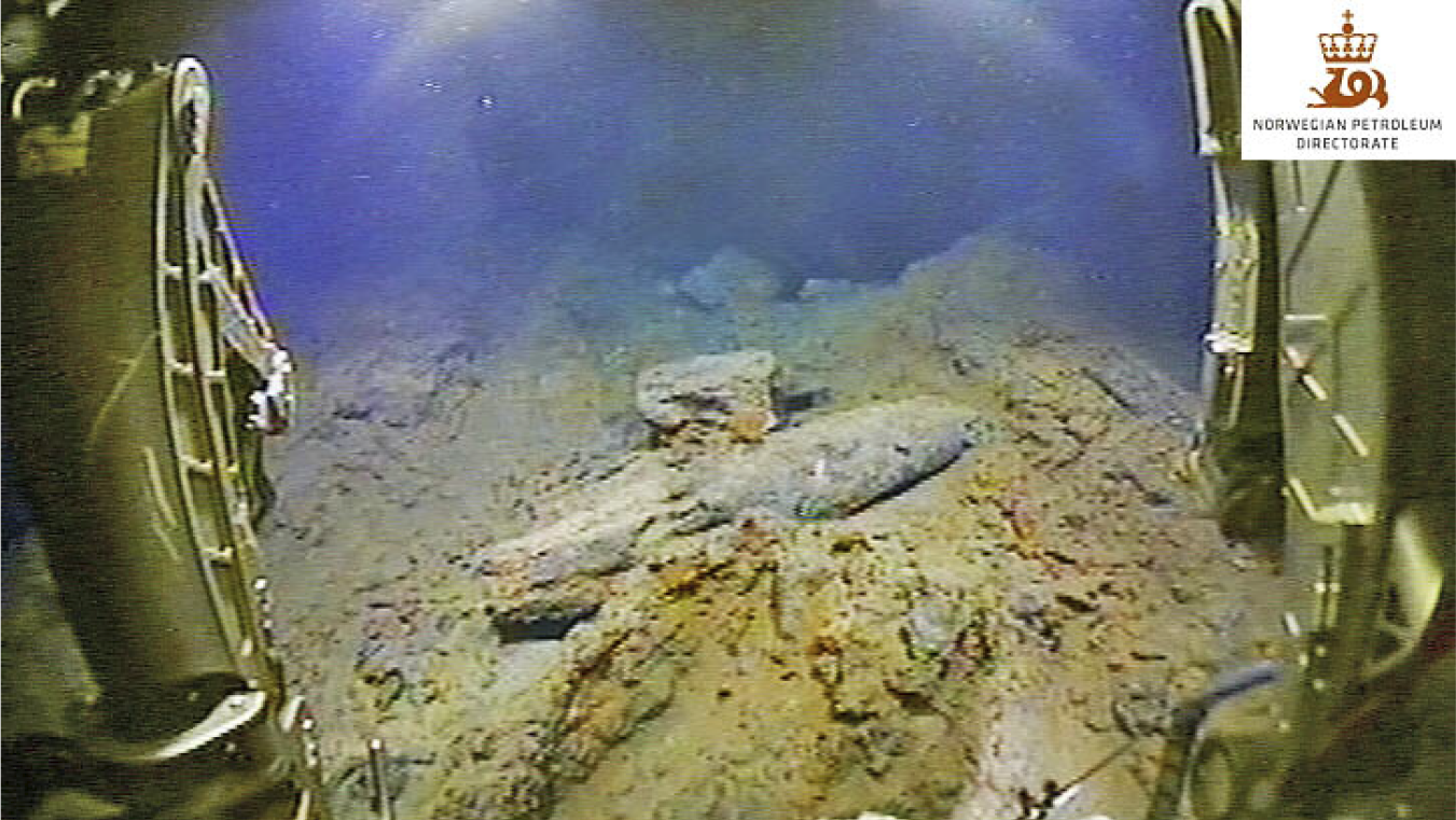 Collapsed non-active smokers (screen shot from operations room. Credit: The Norwegian Petroleum Directorate
The NPD has been assigned the task of proving and mapping deep sea minerals after the Ministry of Petroleum and Energy was given administrative responsibility for mineral deposits on the Norwegian continental shelf.
During this year’s expedition, the NPD surveyed an area of 90 km x 35 km centrally located over the spreading ridge, where water depths vary between 1200 and 3500 meters. The expedition was conducted with the Seabed Worker vessel, which is owned by Swire Seabed AS.
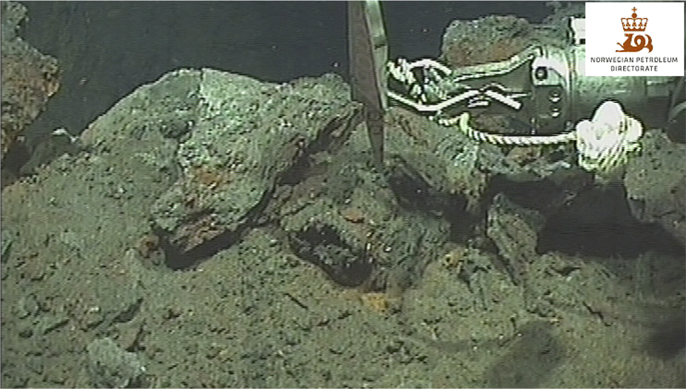 Sulphide minerals as large fragments and gravel piles (screen shot). Credit: The Norwegian Petroleum Directorate
NPD geologist Jan Stenløkk participated in the voyage. He tells us that the mapping was carried out using an autonomous underwater vehicle, Kongsberg Hugin AUV, which mapped the seabed in long corridors, totaling 750 kilometers. The AUV was equipped with several sensors, including seabed penetrating echo sounders. Other types of data collected include multibeam bathymetry, synthetic aperture sonar data, magnetometry and spontaneous potential field data. The AUV was operated by Ocean Floor Geophysics.
“Areas where these data indicated possible mineral deposits were examined using a remote operated vehicle, also known as an ROV, and large volumes of photo and video material were acquired. A number of mineral samples were also collected,” says Stenløkk.
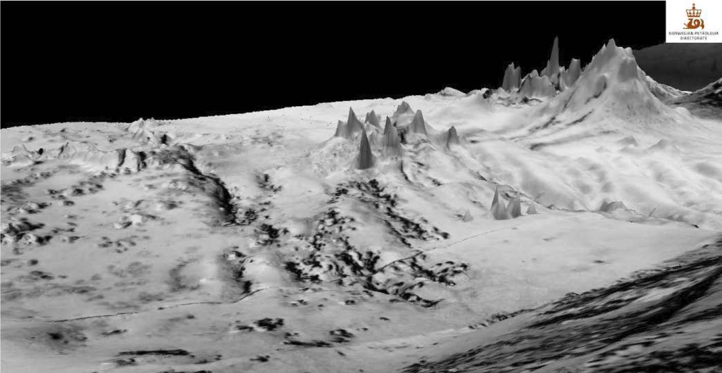 Synthetic aperture sonar data over areas with active and inactive smokers (exaggerated vertical scale). Credit: The Norwegian Petroleum Directorate
The seawater penetrates deep into the seabed, is heated to more than 400 degrees by underlying magma chambers, and dissolves many minerals. The warm seawater is flushed back out to the seabed through so-called “black smokers” where the minerals are precipitated in contact with the cold seawater. When the magma chambers shift due to the spreading between the plates, the flushing of the warm water stops, and the black smokers collapse and ultimately end up as piles of gravel on the seabed.
The new area of sulphide minerals that was discovered contains many such piles of gravel and collapsed black smokers, including a 26-metre high, non-active tower, in addition to some active systems. The mineral samples taken from these piles of gravel will now undergo several analyses. All mapping data from the AUV sensors will also be processed and interpreted.
Exploration director Torgeir Stordal in the Norwegian Petroleum Directorate says that the authorities are very satisfied with the result of this year’s expedition, which is the first mineral expedition operated by the NPD. “It is gratifying that we have found a completely new deposit. We have also tested a number of measurement and mapping techniques that will be useful in future data acquisition expeditions.”