CSA Exhibits Advancements in Underwater and Aerial Imaging
Ocean News
This week’s Esri’s Public Sector GIS Conference (formery the Southeast User Conference) in West Palm Beach, Florida, is an ideal setting for CSA Ocean Sciences Inc. (CSA) to share their advancements using Geographic Information Systems (GIS) tools integrated with customized hardware to collect and analyze video imagery, both subsea and aerial.
![]() On April 11 and 12, CSA analysts and scientists who specialize in the use of GIS tools in projects serving the public sector will be exhibiting at the conference in Booth 112 at the Palm Beach County Convention Center.
On April 11 and 12, CSA analysts and scientists who specialize in the use of GIS tools in projects serving the public sector will be exhibiting at the conference in Booth 112 at the Palm Beach County Convention Center.
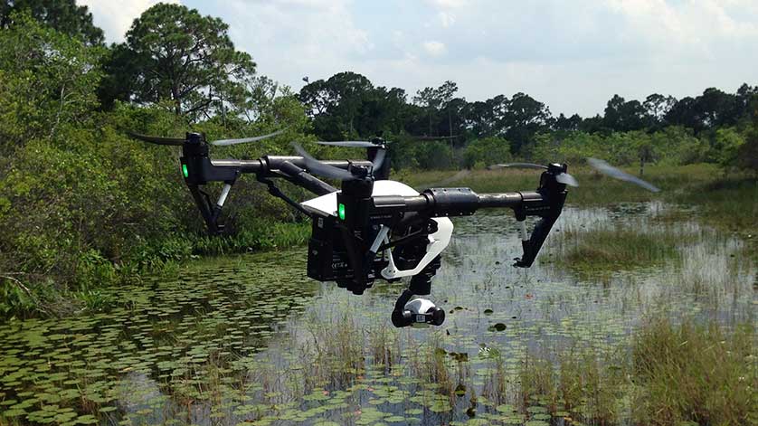
Identifying emerging technologies and their potential applications in examining environmental issues is a core component of CSA’s Environmental Data and Geospatial Services (EDGS). CSA’s EDGS team uses the Esri technology stack, including Full Motion Video (FMV), integrated with other customized hardware, software and web-based mapping portals, to examine local and regional environmental issues along Florida’s shorelines and waterways. CSA’s recent partnership with Morgan & Eklund Inc. (M&E), a hydrographic and land survey firm based in Wabasso, Florida, offers a comprehensive package of environmental and survey services to examine, plan, and execute projects for the public sector. For more on this partnership, click here.
“Integrating cameras, imaging platforms, and geopositioning equipment with advanced survey capabilities offers a great opportunity,” stated Dustin Myers, one of CSA’s leading GIS analysts who specializes in emerging technologies applied to local and regional problems. “Our objective is to provide image collection and analysis services that are platform agnostic, whether using autonomous vehicles, remotely operated vehicles, manned aircraft, divers, or land surveyors as the field platform.”
At the conference, CSA will exhibit examples of recent projects using various platforms, both underwater and aerial, to collect FMV-compliant imagery that is then used to create orthomosaics, run image classifications, and play video over spatial data layers in a web-based platform.
CSA brings 47 years of specialized experience in marine environmental consulting, conducting environmental assessments worldwide through offices in the United States, the Eastern Mediterranean, Qatar, Trinidad, Brazil, Singapore, and Australia. CSA’s expertise with coastal, marine, and deep ocean surveys, including sampling, monitoring, assessment, and mitigation, is built on the integration of science, operations, and an understanding of environmental data collection, management, and analysis within geospatial domains.
More information on the conference can be found here. For more on EDGS, click here.