OceanWise Adds Dynamic Software Extension
Ocean News
OceanWise has added a dynamic software Extension to Maritime Toolbar for Esri ArcMap, which powerfully and easily helps the user to manipulate maritime data.
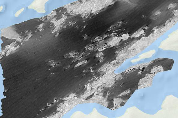
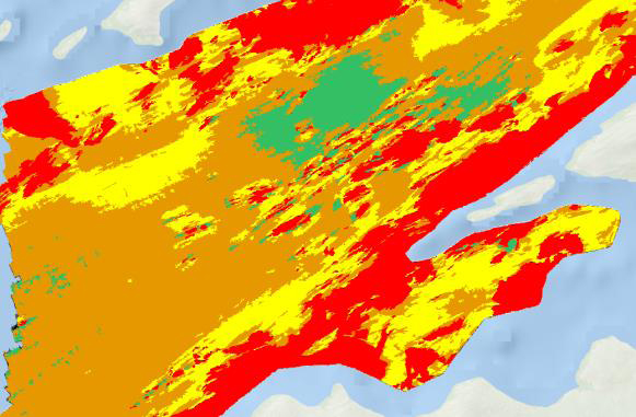 Images: Top: Multibeam image. Bottom image but after RSOBIA has been applied.
This latest extension ‘Object Based Image Analysis’ or ‘RSOBIA’ takes raster imagery and segments the data into geographic areas with similar statistical properties. It interprets the areas and boundaries seen in imagery (such as side scan sonar or multi-beam backscatter) and makes a polygonised map of the results.
This tool works with all types of imagery data and is quick and easy to use, drastically reducing the amount of time it takes to segment images and provides straight-forward, objective polygons which are statistically calculated.
With the emergence of GIS systems, data integration and fusion has allowed numerical and statistical interpretation techniques to be developed. This tool provides a quick and simple aid for classification within a GIS environment, thus supporting workflows.
RSOBIA is brought to market as a collaboration between OceanWise and their Licensed Partner Tim Le Bas, Senior Marine Habitat Scientist for the NOC.
Find out more about Tim Le Bas, the Object Based Image Analysis Extension ‘RSOBIA’ and Maritime Toolbar Extensions (Environmental Samples Management, Hydrographic Survey Management Extensions etc.) here.