Campeche Bank Survey Uncovers Solution Pans in the Gulf of Mexico
Ocean News
Rock features known as solution pans were discovered in the Gulf of Mexico. Their existence means this region — now under water — was once quite arid and helps scientists better understand the past and future of the Yucután Peninsula.
Solution pans are rock features formed by pooling rainwater, primarily in limestone. The rainwater slowly dissolves limestone in an outward motion, creating shallow “craters” or “potholes” in the rock. Solution pans can be found all over the world, specifically in Utah and West Texas, and were recently discovered on the Campeche Bank.
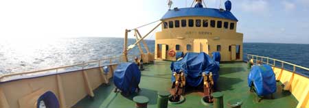
The deck of the R/V Justo Sierra, which was used on the surveying expedition that revealed solution pans in the Gulf of Mexico. (Photo courtesy John A. Goff)
“There are examples of solution pans that are fairly well known. What is startling about our discovery is the size of these features is much larger than anything we’ve seen before,” says John A. Goff, Senior Research Scientist at the University of Texas Institute for Geophysics (UTIG) and lead author of the paper.
The Campeche Bank is a continental shelf in the Gulf of Mexico, surrounding the north and west coasts of the Yucután Peninsula. Goff and colleagues from UTIG and the National Autonomous University of Mexico (UNAM) were in the area for a hazards assessment survey in advance of the International Ocean Discovery Program (IODP) drilling into the Chicxulub impact crater. The discovery of the solution pans was something of an unexpected bonus.
“We were only there to collect data for the safety survey and so the rock features were pure discovery,” says Goff. “Which is neat, because you don’t get to do that too often.”
The survey also revealed sand bedforms on the seafloor running in a northeastern direction, which is inconsistent with the ambient current. Thanks to this research, scientist now have a baseline map to couple with future post-storm surveys to indicate the extent to which storms impact the seafloor in this area.
“Without good information on solution pan growth rates, it’s difficult to ascertain the age of these features or how long they were exposed to arid environments. There are some studies but it is kind of all over the map,” says Goff. “What we do know is solution pans only form in arid environments, so the conclusion can be drawn that this area was once above water must have been very arid for a long period of time. It has great climactic implications.” The more information provided to climatologists about paleoclimate — to what extent the region was arid and for how long —the better they are able to predict future climate change.
The expedition also marked a successful collaboration between UTIG and UNAM, which is located in Mexico City. Ever since Mexico opened its waters for foreign exploration the two universities have been working together to learn more about the Gulf of Mexico. With the help of UNAM, Goff hopes to lead UTIG’s Marine Geology and Geophysics Field Course to the Campeche Bank in 2017 to continue surveying the Campeche Bank.
“This is the first time anybody has looked at the Campeche Bank in this kind of detail, even though it’s right offshore,” says Goff. “There is clearly a lot of interesting morphology there to be discovered, and this sets a precedent for future studies.”