Voyis Underwater Technology Aids in Mapping the Endurance Shipwreck
Patricia Sestari
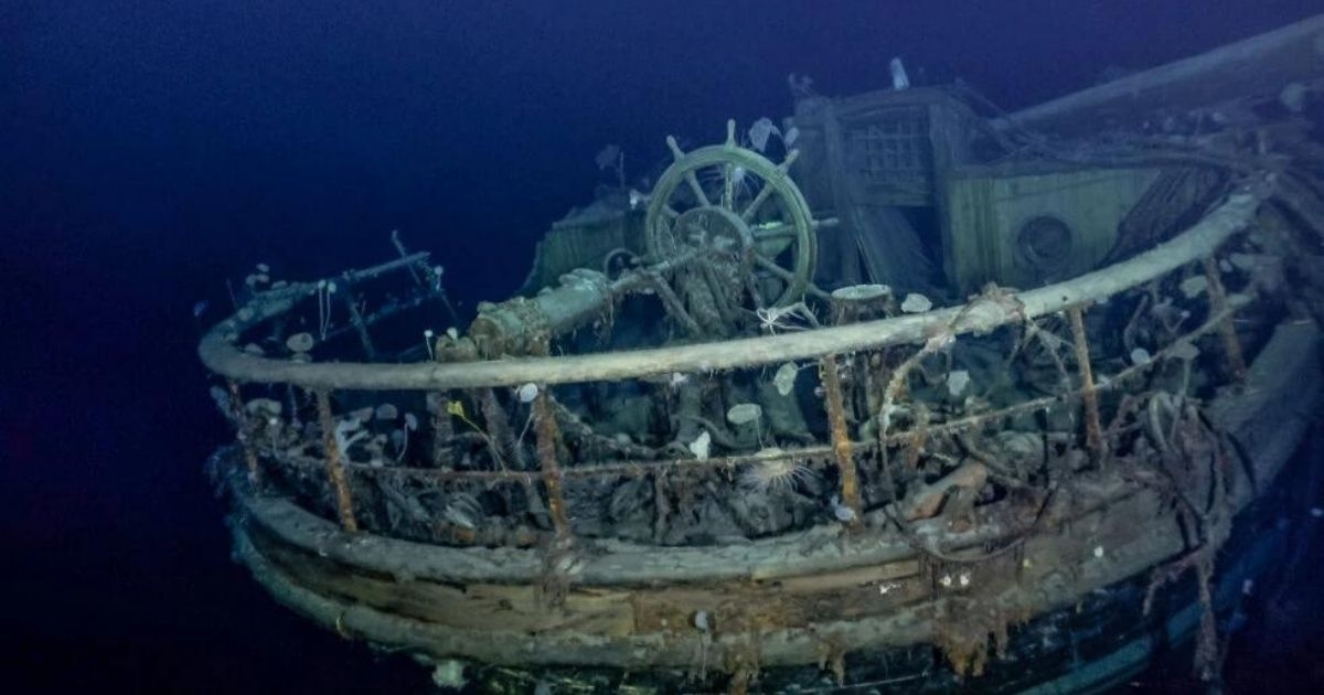
One of the first registers of the Endurance shipwreck. Taffrail and ships wheel aft well deck. Credit: Falklands Maritime Heritage Trust and National-Geographic
The Falklands Maritime Heritage Trust confirms that the Endurance22 Expedition has located the wreck of Endurance, Sir Ernest Shackleton’s ship which has not been seen since it was crushed by the ice and sank in the Weddell Sea in 1915.
 One hundred years after Shackleton’s death, Endurance was found at a depth of 3008 meters in the Weddell Sea, within the search area defined by the expedition team before its departure from Cape Town, and approximately four miles south of the position originally recorded by Captain Worsley.
The team worked from the South African polar research and logistics vessel, S.A. Agulhas II, owned by the Department of Forestry, Fisheries and Environment and under Master, Capt. Knowledge Bengu, using Saab’s Sabertooth hybrid underwater search vehicles. The wreck is protected as a Historic Site and Monument under the Antarctic Treaty, ensuring that whilst the wreck is being surveyed and filmed it will not be touched or disturbed in any way.
Laser Data and Stills Images
Voyis is incredibly proud to be a part of the Endurance Expedition! Now that the wreck has been successfully located, the search team is using Voyis’ advanced underwater technology to digitally recreate the Endurance and surrounding debris field. Voyis’ technology makes this possible by using highly accurate 3D models, and extremely crisp photography generated by the Insight Pro laser scanner, Observer Pro stills cameras, and Nova LED panels.
Using the Insight Pro laser scanner, the survey team will be able to accurately map the Endurance. The Voyis system broadcasts the ultra-dense point cloud model in real-time to the crew, digitally building up the shipwreck as they “fly” over the wreck with the Sabertooth vehicle.
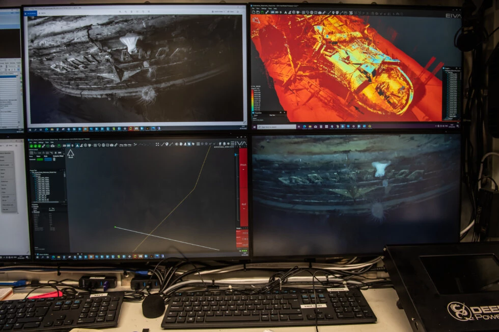 Photo, video and a laser pictures of Endurance22 displayed in the control room of the AUV on board of S.A.Agulhas II. 20220307, Esther Horvath
Complementing the Insight Pro system on this expedition is the Observer Pro imaging system, a long range, highly sensitive digital stills camera, and two extremely high output Nova LED panels to deliver crisp, evenly illuminated stills images.
The Observer Pro imaging system works seamlessly with the Insight Pro laser scanner, providing gapless laser data with interlaced stills. Additionally, images taken by the Observer system are automatically color corrected using Voyis’ machine learning “True-Color” correction, an onboard improvement that replicates the exact color of the shipwreck if it were brought ashore, along with additional undistortion and light leveling algorithms to improve the image quality in real-time. Therefore, it will be possible to create photomosaics and photogrammetric models of the Endurance, to further compliment the highly accurate 3D point cloud model generated by the Insight Pro.
By Patricia Sestari