SevenCs Upgrades ENC Bathymetry Plotter
Ocean News
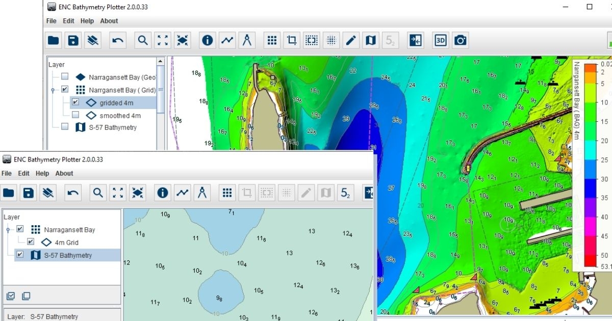
ENC Bathymetry Plotter User Interface* *This image was created from data provided by courtesy of NOAA.
SevenCs' new release of ENC Bathymetry Plotter, has been designed to assist Hydrographic Offices in the production of nautical charts. A key feature of the new software is the improvements in the generation of ENC contours and in selecting soundings. This helps to hugely reduce the manual workload required to develop ENCs.
The contouring process is based on a shoal-biased Nautical Elevation Model. It creates contour lines that have a smooth appearance and that do not require any further generalisation. Manual fine-tuning is possible if users want this. ENC Bathymetry Plotter supports the creation of selected soundings at configurable density, complying with IHO S-4 chart-specification rules. The software can be used to improve ENC data, no matter which type of ENC production system a particular HO uses.
ENC Bathymetry Plotter has been developed from scratch and runs on an entirely new architecture, using a completely renewed source code. The new software integrates a variety of significant functional extensions, modifications, and many improvements. It also provides a substantially larger set of functions and tools, including:
- New layer management
- Advanced sounding selection
- Manual fine-tuning of Nautical Elevation Model
- Additional coordinate reference systems (incl. geographic coordinates)
- Clipping of bathymetry data; chart trimming
- Highlight function, showing where updated bathymetry deviates from existing charts
- Additional input formats (e.g. S-102)
- ENC display
Significantly, ENC Bathymetry Plotter is S-102-compatible, future-proofing the software in line with the significant changes to industry-wide data-compatibility standards.