Hidden Depths: Unlocking Our Oceans’ Hydrographic Data
Ocean News
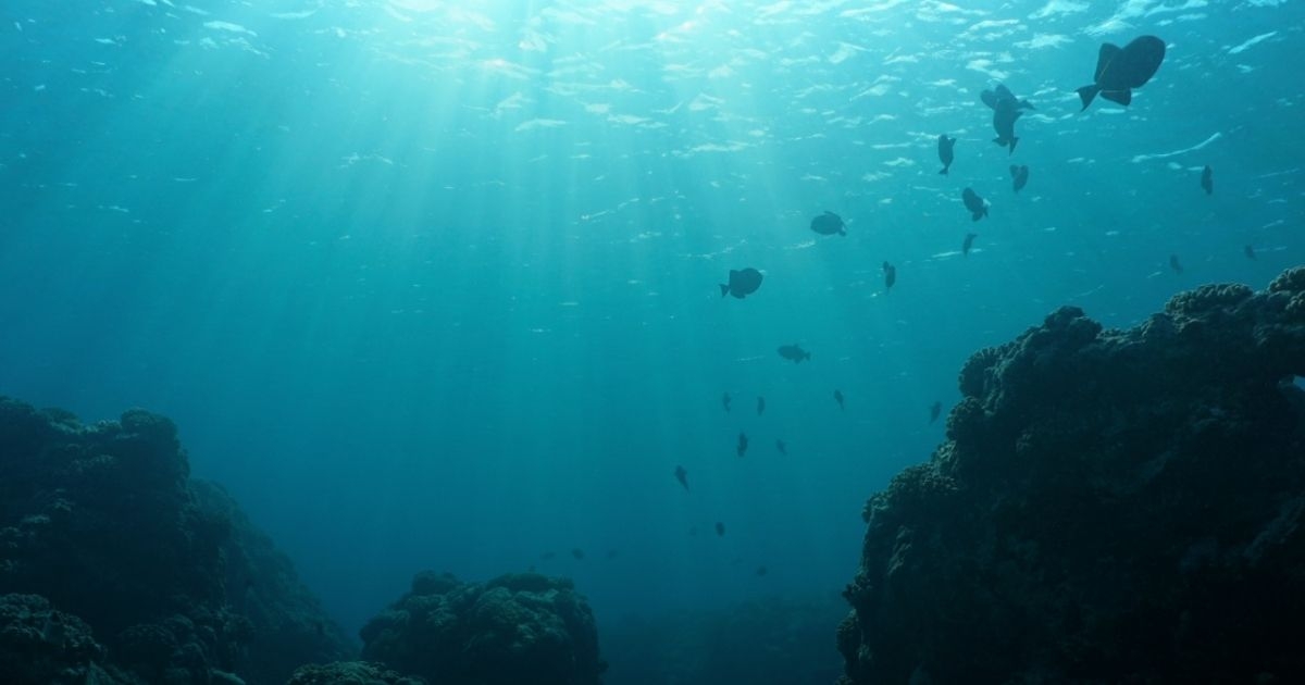
The world’s oceans play an important part in our existence on earth, yet very little is known about them. More information is needed but acquiring hydrographic Geo-data is not always an easy task. Jaco Stemmet, Fugro’s Director of Africa and an IHO Category A Hydrographic Surveyor, explains more.
Hydrography measures the physical features of seas and coastal areas around the globe. Knowing the water depth and understanding the shape of the seafloor can improve the safety of marine navigation and support other marine activities, such as the blue economy, security and defense, and environmental protection. For this reason, hydrography is playing a key role in two major collaborative initiatives currently mapping the seafloor: the UN Decade of Ocean Science for Sustainable Development and the Seabed 2030 project.
Given the complex nature of hydrography, rather than acquire their own data, many government and hydrographic organizations engage a hydrographic survey provider to benefit from their specialized skills and accreditations. Each data acquisition project comes with its own unique set of parameters, including the demand for high-quality hydrographic information, and safe and sustainable operations, but cutting-edge hydrography technology is solving many of these challenges.
Demand for hydrographic information
Navigational charts require the highest quality data. Updating them used to be time-consuming and costly but new technologies and techniques are accelerating data acquisition and delivering accurate hydrographic data. For example, our Blue Shadow USV acquired high-quality hydrographic data for a project in Australia, which was then used to update nautical charts for safer navigation.
Hydrographic data are also used to identify areas most at risk from rising sea levels and an increase in storm events. For example, Fugro deployed their Rapid Airborne Multibeam Mapping System to collect bathymetric data for a project to identify areas most at risk of erosion and flooding along Northern Ireland’s 763 km of coastline, capturing high resolution data to depths of three times the visual water clarity.
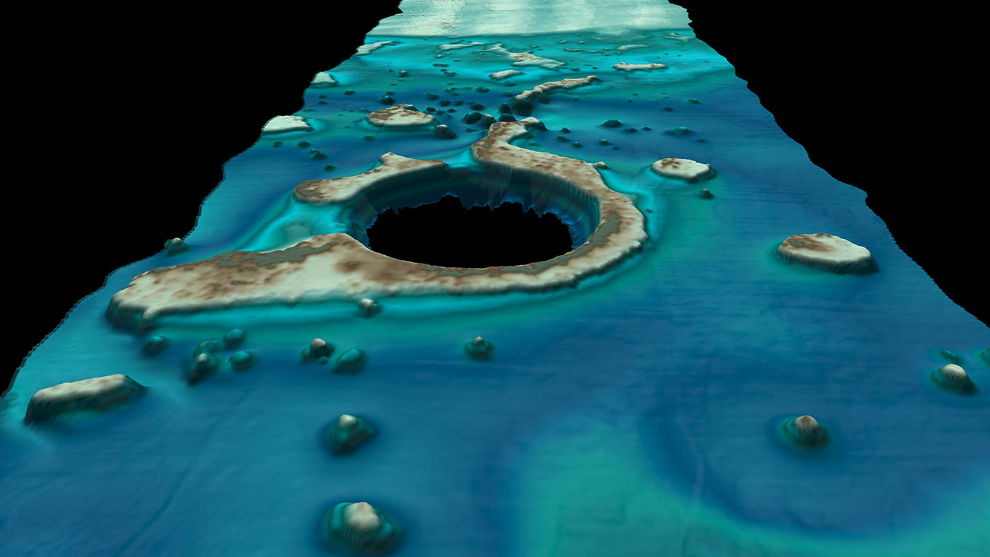 Data visual captured from Fugro RAMMS (Rapid Airborne Multibeam Mapping System)
Finally, accurate insights on seabed formation, geology and water depths are essential for reducing engineering risk on marine infrastructure projects. For example, during an offshore project in Mozambique, Fugro identified a steep underwater cliff along the proposed pipeline route. This would have jeopardized the long-term structural integrity of the pipeline. Having surveyed the entire area and studied the water depth and currents, our consultants selected a safer alternative route.
Safe operations
There are inherent health and safety risks associated with personnel working on large survey vessels offshore to acquire hydrographic data, especially in coastal environments. Uncrewed surface vessels (USVs) and remote operations centers (ROCs) can mitigate or remove these risks. For example, USVs can conduct hydrographic surveys close to offshore wind turbines without interrupting operations and allow crewed vessels to remain at a safe distance from the asset to avoid unnecessary risk for those onboard. This has the potential to reduce human exposure to hazardous offshore environments by up to 100 %. Through their flexible deployment and good connectivity with the parent vessel and/or onshore ROCs, USVs can acquire data faster and safer than ever before.
Sustainable operations
Maritime shipping emits around 940 million tonnes of CO2 annually and is responsible for approximately 2.5 % of global greenhouse gas emissions, so hydrographic organizations have sustainability targets to meet, including for their data acquisition. USVs consume only a fraction of the fuel of some crewed survey vessels, which means a lower carbon footprint. For example, by deploying our Blue Shadow USV for a hydrographic survey in Australia, we reduced carbon emissions for the project by 96 % compared to using a conventional survey vessel.
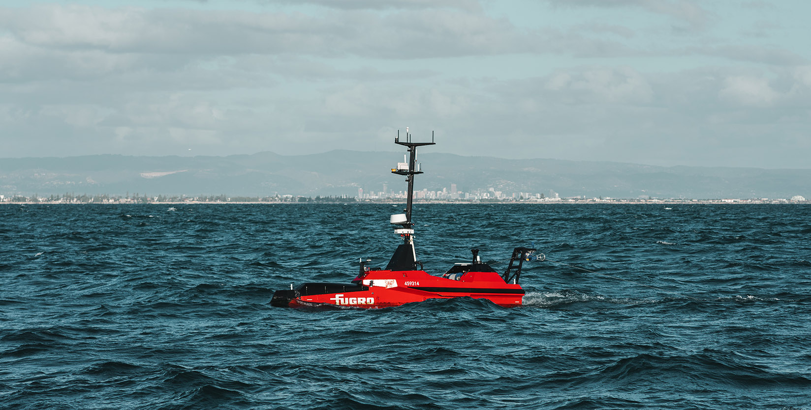 Blue Shadow USV undergoing optimization trials in Australia
In conclusion
The world’s oceans affect our everyday lives and yet we know very little about them and what lies beneath. Obtaining high-quality hydrographic data in a safe and sustainable manner is key to mapping out the physical characteristics of the seafloor for the safe use and protection of the maritime environment and to support the blue economy.
Did you know?
- More than 80 % of the world’s oceans are unmapped, unobserved and unexplored
- USVs reduce data acquisition time by up to 50 % compared to traditional large-scale survey vessels
Source: Fugro