Fugro’s Geo-Data Technology to ‘Preserve’ Cosquer Cave Prehistoric Art
Ocean News
Rising sea levels are gradually effacing the cave’s display of 177 exquisite and irreplaceable paintings and engravings, dating back to 27,000 BC but Fugro will use their Geo-data scanning technology to create a permanent record of huge cultural significance.
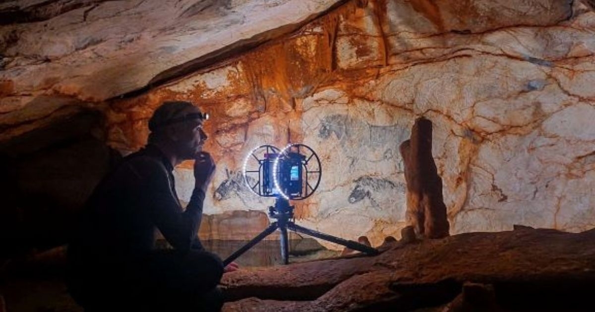
In challenging conditions, and together with Immadras, a French professional diving company, Fugro will use the latest photogrammetric, 3D laser scanning and lighting technology to digitize and map the cave. The artwork above the surface is recorded in full color and meticulous detail (0.1 mm resolution), and a lower resolution will used for the underwater section, which accounts for around two-thirds of the cavity. Fugro will then produce a highly accurate, georeferenced 3D model of the entire cave structure. This will provide invaluable insights for archaeological, paleontological and climatological researches, and for future generations. Fugro will also model the landscape surrounding the entrance, 37 m below sea level, as well as the narrow, 120 m underwater access tunnel leading up to the cave. The project is scheduled for completion early next year.
Luc Vanrell, Immadras’s Project Manager for scientific missions in the Cosquer Cave, said: “To achieve the objectives of a fully exploitable 3D digitization for our scientific team, we needed a provider that could mobilize and develop multiscale 3D survey technologies, above and below water, and in extreme conditions. Fugro is the perfect partner to support us in this crucial mission.”
Bertrand Chazaly, Fugro’s Digital and 3D Expert conducted Fugro’s initial 3D survey in September 2010 and has since completed more than 70 dives. In May he returned to complete this urgent project with Luc Vanrell, which will require a further 45 dives and a painstaking approach to avoid damaging the beautifully preserved cave. “Many of the paintings of horses and hands are perilously close to the rising water level,” said Chazaly. “Fugro’s job is to map and record these precious works of art before they are lost forever, and to model the underwater structure. Archaeologists will then use our Geo-data to gain a better understanding of how prehistoric humans lived in the cave and the positioning of the various groups of paintings.”