Celebrating a Major Milestone in Fugro’s Support of Seabed 2030
Ocean News
By Shannon Earl, Marketing & Public Relations Manager, Americas
In 2016, Fugro envisioned a supercharged crowdsourced bathymetry program to support the global ocean mapping initiative, The Nippon Foundation GEBCO Seabed 2030 Project. Five years later, Fugro’s approach has generated more than two million km2 of high-resolution bathymetry for the project, serving as an example for similar engagement by others in the maritime industry.
Seabed 2030 is a collaborative project between The Nippon Foundation and the General Bathymetric Chart of the Oceans (GEBCO) to inspire the complete mapping of the world’s ocean by 2030 and to compile all bathymetric data into the freely available GEBCO Ocean Map. These data are needed to address many significant challenges posed by population growth and climate change. As an early partner of Seabed 2030, Fugro has supported the project in numerous ways, perhaps most notably through contributions of high-resolution bathymetry collected while transiting between project locations.
How it started
The International Hydrographic Organization (IHO) defines crowdsourced bathymetry as “the collection of depth measurements from vessels, using standard navigation instruments, while engaged in routine maritime operations”. Historically, this concept involved the provision of 'passage soundings' to support the updating and improvement of nautical charts.
David Millar, Fugro’s Government Accounts Director for the Americas and a current member of the GEBCO Guiding Committee and IHO Crowdsourced Bathymetry Working Group, recognized the potential for Fugro to adopt a similar approach for the benefit of Seabed 2030. “We were already using remote command and control technologies to improve safety and efficiency in our offshore operations, so applying these systems and processes to collect valuable bathymetry data during transits that were occurring anyway seemed like an obvious way for Fugro to make a meaningful contribution to the project,” David explained
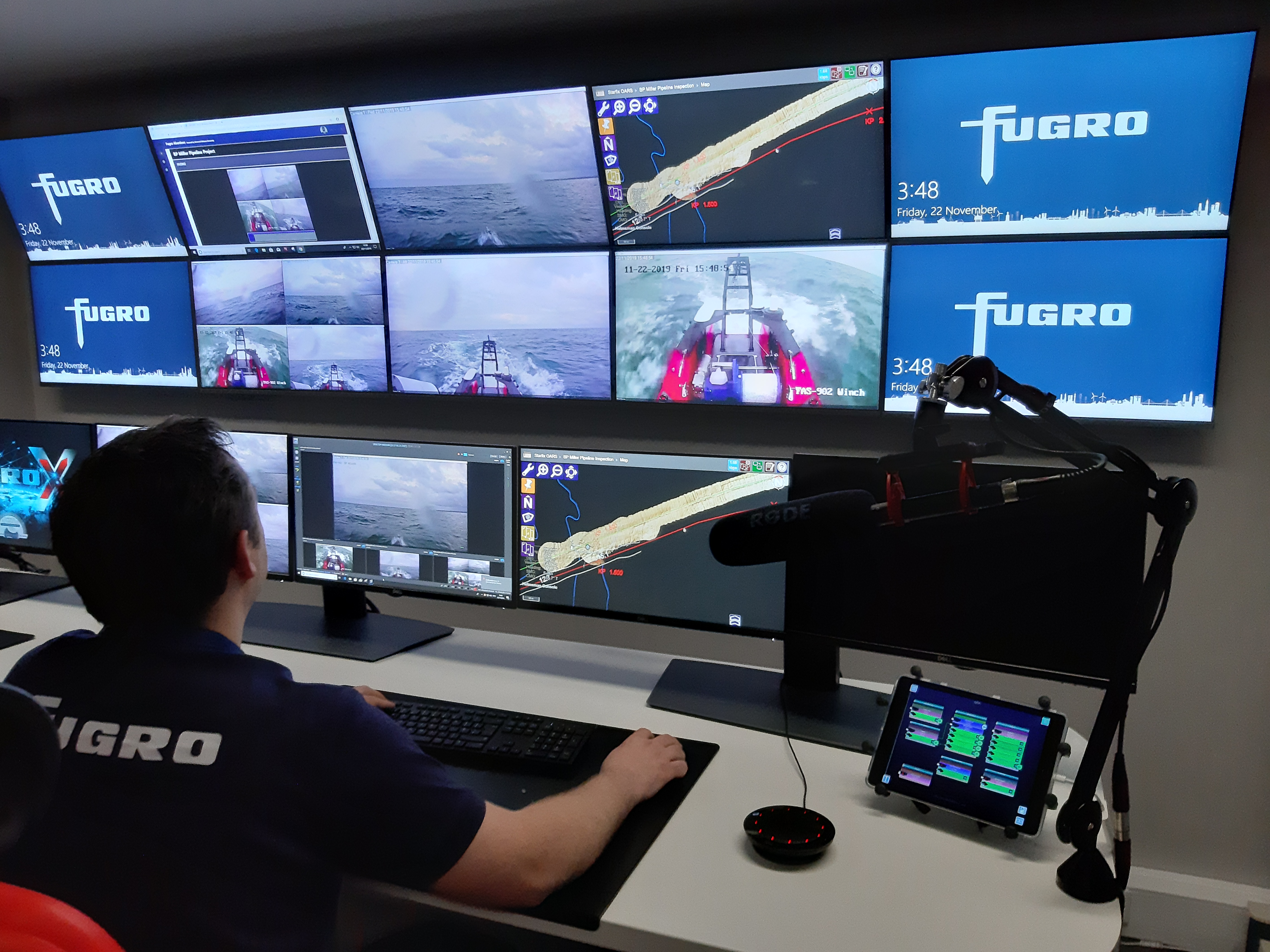 Fugro operates a global network of Remote Operations Centers (ROCs).
Edward Saade, then Group Director for Fugro in the Americas agreed, greenlighting a pilot project to test the concept. In September 2016, while transiting in the Atlantic Ocean basin, the MV Kobi Ruegg, Fugro successfully acquired 8,500 km2 of high-resolution multibeam echosounder data where none previously existed. Other transits soon followed and in November 2017, Fugro made the first delivery of in-transit bathymetry data to Seabed 2030 via the IHO Data Center for Digital Bathymetry (DCDB). That contribution totaled approximately 65,000 km2 of high-resolution seafloor mapping data to the project.
How it’s going
Over time, Fugro has successfully expanded their in-transit bathymetry program to include nine vessels operating globally, with more planned. “The ability to manage the data collection remotely without survey crew onboard is critically important to scaling up the program and continuing to make cost-effective, high-impact contributions that help foster a healthy and understood ocean,” David said.
Fugro delivers in-transit bathymetry data to Seabed 2030 approximately twice per year, a frequency that provides a reasonable volume of data to be acquired, uploaded and ingested by the DCDB and regional Seabed 2030 data centers. Fugro’s December 2021 submittal represented a major milestone: more than 2 million km2 of high-resolution, in-transit bathymetry collected by Fugro vessels has now been delivered to the Seabed 2030 project. Combined, this data coverage is roughly equivalent to the size of Mexico!
Reflecting on this milestone, Jamie McMichael-Phillips, Seabed 2030 Project Director, stated: “We are immensely grateful for the tremendous submission of data by Fugro, who have been one of our biggest supporters from the onset of the project. From participating in the early planning stages to launching their intransit data campaigns, Fugro has adopted an invaluable and central role in helping Seabed 2030 achieve its aim of a complete map of the world’s oceans by 2030. We look forward to continuing this partnership with Fugro in the time remaining for us to achieve our goal.”
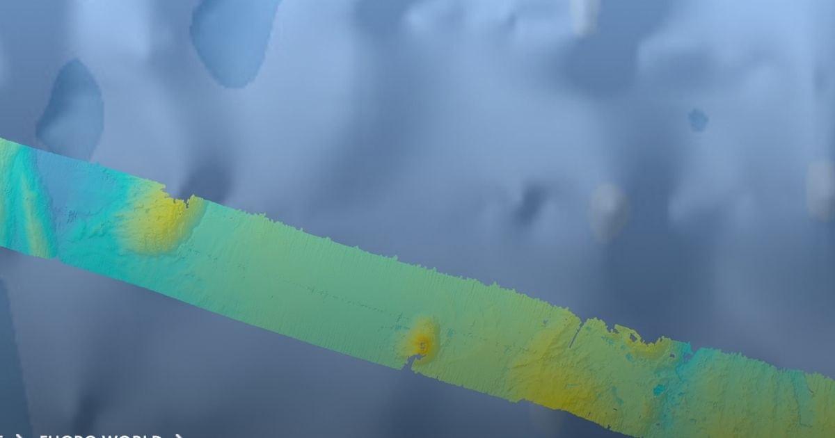
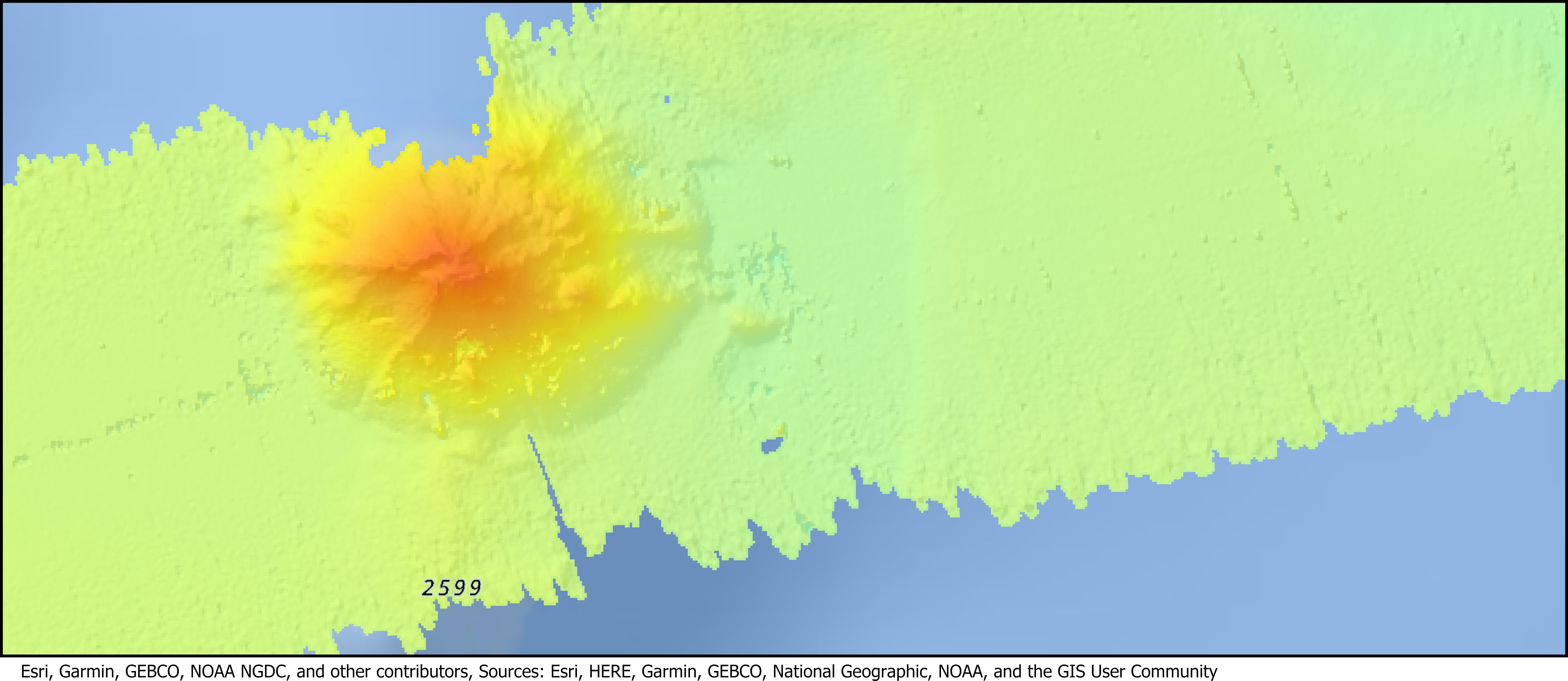 Esri, Garmin, GEBCO, NOAA NGDC, and other contributors, Sources: Esri, HERE, Garmin, GEBCO, National Geographic, NOAA, and the GIS User Community. Example of high-resolution, in-transit bathymetry acquired by Fugro superimposed over low-resolution data from existing GEBCO database.
Furthering the cause
While crowdsourced bathymetry is just one of the ways Seabed 2030 aims to ’map the gaps’, it’s a strategy with yet untapped potential. As described in a short film co-produced by Fugro and Seabed 2030, multiple other marine industries are also well suited for in-transit data collection. Relatively simple vessel modifications would enable commercial shipping and cruise line companies, for instance, to make meaningful contributions to the project and, by extension, the United Nations Decade of Ocean Science for Sustainable Development.
Ensuring a wholly mapped ocean by 2030 will require cross sectoral, interdisciplinary collaboration and partnerships worldwide. As the world’s leading Geo-data specialist, Fugro is very proud to champion the private sector’s support of Seabed 2030 and hope you will join the cause! Learn more here.
Did you know?
When Seabed 2030 officially launched in 2017, only 6% of the world’s oceans were mapped using modern technologies. Today, that figure has grown to 20.6%.