RH Marine Helps Naval Vessels Navigate More Accurately
Ocean News
By adding new technology and features and integrating them with the navigation systems on the bridge, RH Marine enables naval vessels to navigate more and more accurately. This allows them to better fix their position, better detect other objects and become less dependent on GPS.
In order to give naval vessels more opportunities to fix their position, the Dutch leading system integrator has integrated an optical bearing device (OBD) in WECDIS, RH Marine’s digital chart system for military purposes. The optical bearings of objects, such as lighthouses and other landmarks, are automatically displayed on the digital chart. Also, the system can send back data to the OBD, which makes it unique in the industry.
Objects that are important for navigation can also be embedded into the radar grid log, so that the radar can fix the ship’s position based on these fixed points. Both features make naval vessels less dependent on satellite navigation systems like GPS. Those systems can be distorted and are sometimes less accurate.
 In order to improve the accuracy of position fixes, RH Marine has developed R95 Ellipse. This special algorithm calculates the most likely position of the ship with 95 percent accuracy, based on radar, GPS or OBD bearings. That position is displayed on the map in the form of an ellipse. “This ensures that the various departments or even ships know that they' are all talking about the same target.,” says portfolio manager Marcel Vermeulen of RH Marine.
To make it easier for naval vessels to enter a port using optical navigation, they can log visual bearings of known objects like lighthouses as a landmark in the navigation system.
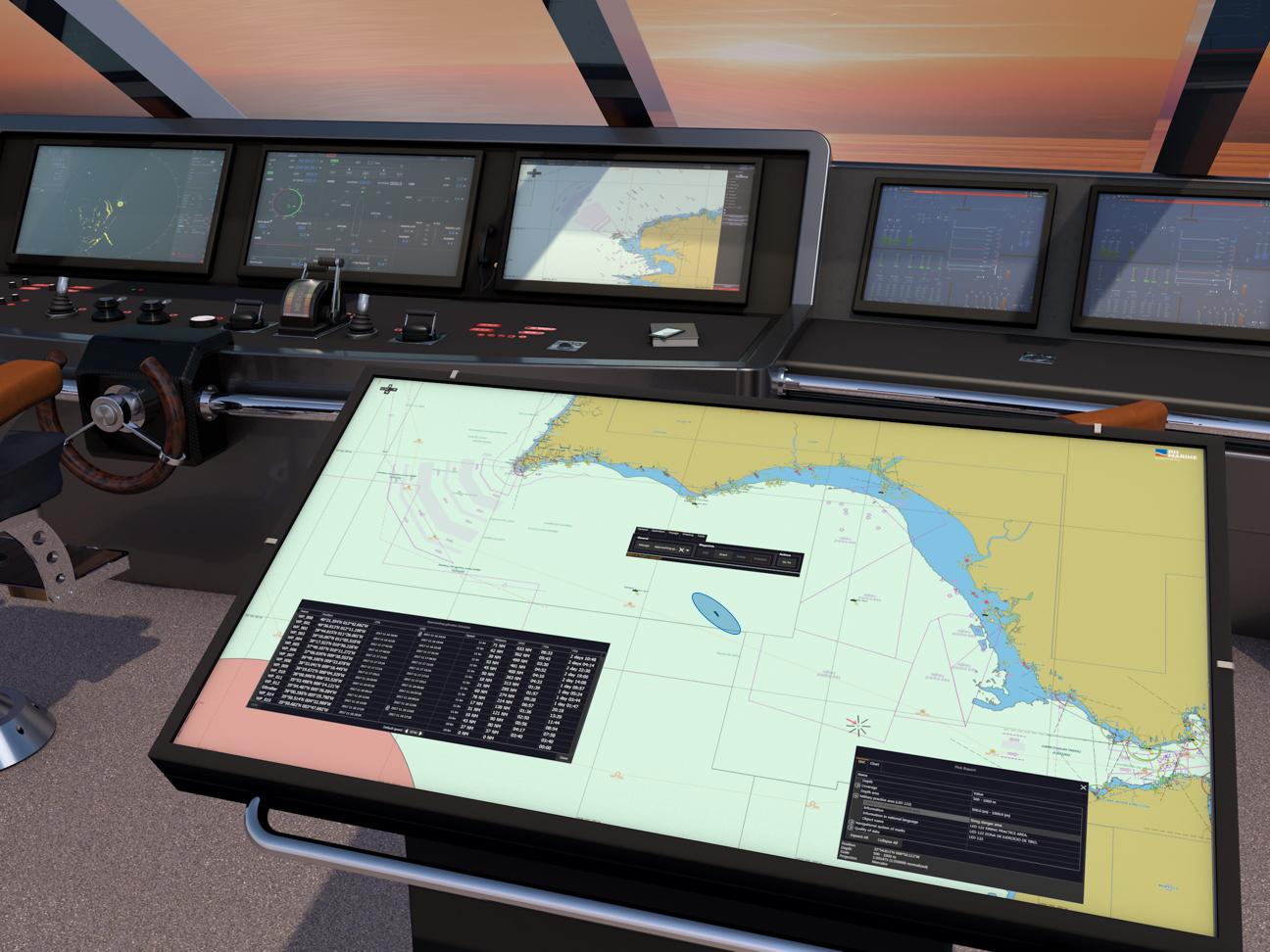
RH Marine also extended its Voyage Planning Station (VPS), a 55-inch touchscreen that replaced the former paper chart, with new features. In addition to pointing, planning and calculating voyages and routes, photos and videos can now be added. These can be viewed with one click on an icon on the digital sea chart. This makes places and objects more visible, especially if these data are shared with the entire fleet “The VPS offers a lot of added value for both the navy and yachts.” says Vermeulen. Most new features we add are requests from end users in the operational branch. We are able to translate those requests into new technological features. That is what we do best.”
The development of software for augmented reality glasses (AR) for bridge officers can also be seen in that context. Because they have to watch screens more and more while navigating, there is a need to project the most relevant data as virtual layers onto those kinds of glasses, while they are looking outside. Vermeulen: By developing this we again prove that we are the innovative company that allows navy vessels to navigate better.”