Using Gliders For Long-Term Ocean Observations
Duane Fotheringham
The Seaglider uses changes in buoyancy to move through the ocean in a sawtooth pattern while collecting data. (Image credit: HII)
Long-term ocean observations can be extremely costly and time-consuming. Typical data collection methods include large, manned platforms on or above the water that drive sensors to areas of interest. The operation and maintenance of a research vessel, with equipment and crew, traditionally have been a massive endeavor.
As unmanned maritime systems have evolved, they have emerged as cost-efficient methods for collecting ocean data. In the early 2000s, underwater gliders were introduced to the oceanographic community as an addition to the suite of tools used in oceanographic research. Today, gliders are an integral part of ocean observations, collecting physical, biological, optical and acoustic data sets with high temporal and spatial resolution at a fraction of the cost of ship-based data collections.
THE SEAGLIDER
The Seaglider® Autonomous Underwater Vehicle (AUV) was developed by the University of Washington in 1995 and is manufactured and sold commercially by Huntington Ingalls Industries’ (HII) Technical Solutions division. More than 150 Seagliders have been sold to 16 countries worldwide for various applications, including climate research, intelligence, surveillance and reconnaissance (ISR), and marine research. They are reliable and robust, and can replace manned platforms to autonomously collect data for long-endurance missions.
There are two variants for littoral and deep-water missions: The new Seaglider C2, which is 200-meter-rated, and the Seaglider M1, which is 1000-meter-rated. They are two-man portable and use changes in buoyancy to move through the ocean in a sawtooth pattern. Internal sensors monitor vehicle heading, depth and attitude during dives. Buoyancy changes are achieved through the inflation and deflation of an oil-filled bladder and allows diving through water with up to a 10 density differential without adjustment of the ballast.
Because there are no external moving parts, the vehicles are quiet, durable and energy efficient. The C2 achieves endurance up to three months, and the M1 achieves endurance up to 10 months, dependent on active sensors and sampling rate. The Seaglider takes measurements from different levels in a water column, providing temporal and spatial scales not possible with research vessels.
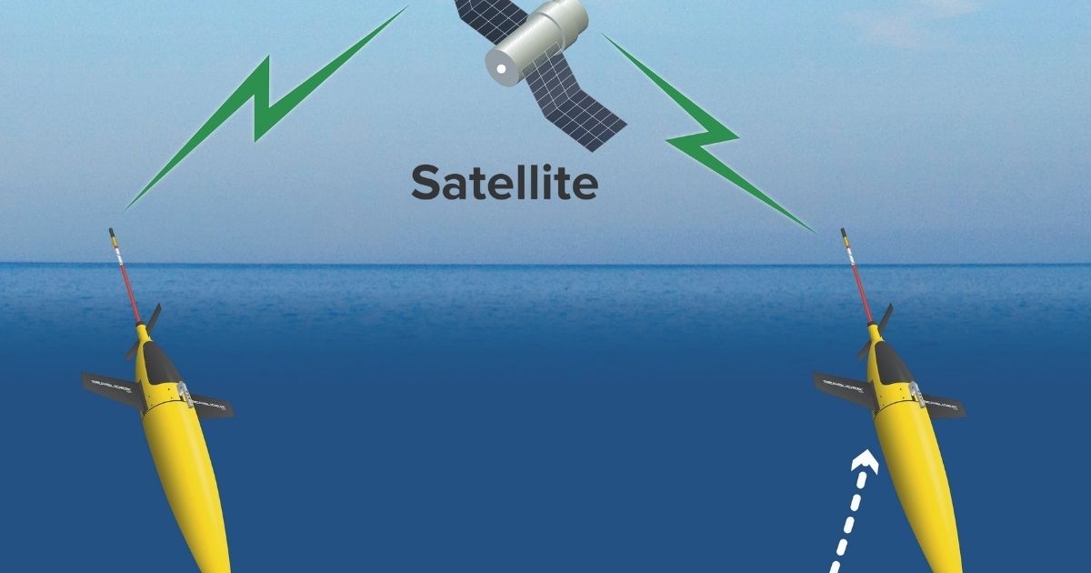
Seagliders can be equipped with a variety of sensors, including conductivity/temperature/depth (CTD); dissolved oxygen; backscatter and fluorescence; microturbulence; passive acoustics; acoustic doppler current profilers (ADCPs), and echosounders. Data is transferred anywhere in the world via satellite communications in near real-time based on user-defined intervals. When surfaced, the Seaglider also obtains a GPS fix to aid in navigation and can receive new commands or updated missions via satellite.
CLIMATE RESEARCH
Climate change has echoing effects throughout the world, especially with the ocean. The Seaglider allows for measurement and calculation of factors like salinity and temperature, which aid in climate change studies. Because they are untethered, Seagliders can access remote or hazardous locations and have been used everywhere from the Caribbean Sea, monitoring hurricanes, to polar ice regions, investigating the thinning of ice shelves. They have made multiple passes of the Drake Passage, studying air-sea-ice flux and have tracked eddies across the Pacific Ocean for more than nine months at a time. Since the Seaglider is underwater most of the time, sea state and storm conditions are not a high risk to missions or equipment.
INTELLIGENCE, SURVEILLANCE & RECONNAISSANCE (ISR)
The Seaglider has participated in military exercises, including TASWEX 04, RIMPAC 06 and REP14. The robustness and reliability make it a stable, covert platform for ISR missions. Without the need for a propeller or external moving part, the vehicle is extremely quiet. It can also be programmed to surface infrequently to minimize surface expression. The Seaglider has been outfitted with multiple ISR sensors, including passive acoustic sensors.
MARINE RESEARCH
The study of marine life can be aided by Seagliders, which are used by researchers around the world to collect data needed to better understand marine processes and concerns. Seagliders carrying a passive acoustic sensor payload are used to meet environmental monitoring regulations regarding the proximity of marine mammals to events such as oil and gas operations and naval exercises and to better understand the habits of marine mammals. When outfitted with echosounders, it generates biomass estimates without the need to catch specimens. Measurements of dissolved oxygen, salinity and temperature give insight into water quality and the health of the ecosystem.
THE FUTURE OF SEAGLIDERS
As technology continues to progress and evolve, our Seagliders must do the same. At HII, we are always looking for ways to increase endurance by optimizing SWaP: size, weight and power. We are investigating new, higher-density power sources to increase endurance and our partners help customize sensors and payloads to minimize weight and size to increase vehicle capabilities. Modifications to the variable buoyancy system can increase the density range of operations, allowing Seaglider to easily transition from fresh water to salt water without the need to reballast.
CASE STUDY: NOAA AOML Seagliders for Hurricane Monitoring
The National Oceanic and Atmospheric Administration (NOAA) Atlantic Oceanographic and Meteorological Laboratory (AOML) has been using a fleet of Seaglider AUVs since 2014 for hurricane monitoring. The data collected by the program is used to improve the operational hurricane models and their prediction of the track, intensity, structure and amount of rainfall throughout the life-cycle of a storm. NOAA AOML Seagliders measure temperature, dissolved oxygen, chlorophyll concentration and chromophoric dissolved organic matter (CDOM) and collect data needed to derive salinity.
NOAA AOML and partners deploy Seagliders during hurricane season to the Caribbean Sea and tropical North Atlantic Ocean. Missions last about four months from mid-July to mid-November, and Seagliders collect data on temperature and salinity profiles around tropical storms and hurricanes. In 2020, NOAA AOML and partners completed a total of nine four-month missions with Seagliders, collecting more than 13,000 individual temperature and salinity profiles without loss of a single vehicle.
Since 2014, Seagliders have gathered more than 40,000 data profiles. They have operated around hurricanes up to Category 5, collecting and transmitting sustained and targeted ocean observations. NOAA AOML has found that high heat and low salinity may create conditions that are appropriate for hurricane intensification. By feeding the data into NOAA’s hurricane forecast model, they help improve the five-day intensity forecast.
For more information about the Seaglider AUV, visit tsd.huntingtoningalls.com/unmanned.
This article was originally featured in ON&T February 2021. Click here to read more.