Uncrewed Ocean Data Solutions
Brian Connon
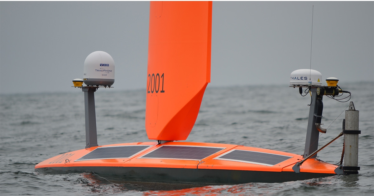
(Image credit: Saildrone)
Whether in the name of scientific discovery, offshore exploration, or maritime awareness, ocean professionals are calling for new and practical ways to acquire, process, and analyze increasingly diverse and robust ocean data sets.
This demand is, in no small part, being driven by our expanding technical capacity and the steady integration of artificial intelligence (AI), machine learning (ML), and sophisticated control and communication systems, all geared to stretch our collective ambitions to inspect and protect the blue planet.
Take ocean mapping, for example. In June 2022, The Nippon Foundation-GEBCO Seabed 2030 Project—which seeks to produce a definitive global seabed map by 2030—updated the global coverage of seafloor mapping from 20.6% in 2021 to 23.4%. This represents a year-on-year addition of 10.1 million square kilometers of new bathymetric data and another significant milestone, given that coverage back in 2018 was a mere 6.7%.
TURNKEY USV SOLUTION
Progress of this magnitude and pace relies not only on unprecedented cross-sector collaboration but also on the trial and acceptance of intelligent, economically feasible technologies designed to extend our reach further offshore while reining in any associated carbon footprint or HSSE exposure.
Saildrone’s role in this transition is to provide cost-effective data at scale by operating a growing fleet of Uncrewed Surface Vehicles (USVs) built to withstand the rigors of deployment in the most remote and hazardous seas.
We have branded our bundle of hardware, software, and in-field expertise as our mission-as-a-service (MAAS) offering, of which there are three elements: first, the operation of our uniquely capable and customizable USVs; second, access to an intuitive web portal that offers advanced collaboration features and real-time mission planning tools; and third, a transparent data chain of custody, from raw observations to the real-time validated data.
The result is a genuinely turnkey solution, delivering high-quality data at a fraction of the costs and risks associated with traditional survey methods.
SCALING UP THE SAILDRONE FLEET
While some of our USVs have been designed with specific applications and capabilities in mind, each of our three base models—the 7-meter Explorer, 10-meter Voyager, and 20-meter Surveyor—has been developed to achieve the optimal balance between mission payload flexibility and endurance.
All our USVs are wind- and solar-powered, and so capable of year-round deployment. The Voyager and Surveyor are also supported by onboard generators and additional diesel/electric propulsion options for voyage extension and increased maneuverability.
We are ramping up for a major fleet expansion in 2023. We currently operate around 100 Explorers, 1 Voyager (which acts more as a testbed for planned enhancements), and 5 Surveyors. By the end of the year, we aim to launch 30 – 40 of the mid-sized Voyagers and 10 – 15 of the larger Surveyors. Some of the new USVs will feature an upgraded aluminum hull (versus composite), which will not only speed up production but bring added agility to the USV. It would prove completely unfeasible to scale the production of full ocean depth research vessels (and crews) like this but is perfectly attainable—with the right infrastructure and industry partnerships—when it comes to reinforced, long-endurance multipurpose USVs.
OCEAN DATA WHEN YOU NEED IT
Saildrone USVs are outfitted with an Iridium satellite connection and full resolution data is stored on board. The mission portal allows customers to see a time series of all the data. For bathymetry missions, clear raw data depictions can be used for initial analysis on which users can then communicate directly with the pilot should they wish to redirect the drone to a specific area or data point. While transferring raw multibeam bathymetry off the vehicle in real time is impractical, when the USVs pull into port you can download the high-resolution imagery and video.
Perhaps our most notorious and arresting video footage to date came about by sending modified Explorer USVs into the path of major Atlantic hurricanes. Unsurprisingly, scenes of nature at its most brutal—the relentless churn and chaos of towering waves—couldn’t help but capture the imagination, but the underlying objective behind these two separate missions, one in 2019 and one in 2022, was to collect environmental data in partnership with the National Oceanic and Atmospheric Administration (NOAA).
This data, recorded by over 20 onboard sensors, is essential to furthering our understanding of the complex meteorological interactions that trigger massive storms to intensify so rapidly. And it is not just the atmospheric variables—sea surface temperature, salinity, dissolved oxygen, relative humidity, barometric pressure—that will bring great accuracy to forecast models but also information about the system’s energy flux.
COMPLETE MARITIME AWARENESS
However, the utility of Saildrone USVs extends far beyond mapping and probing extreme weather. The cameras on our USVs, which take images every five seconds, use a proprietary dataset of tens of millions of maritime images. These images have been annotated by Saildrone to train our AI applications to enable real-time intelligence and decision support for marine domain security.
This has far-reaching applications for surveillance ops, whether for coastal border control, illegal fishing, the interception of narcotics, etc. Launching crewed vessels or aircraft to run full-time patrol missions of this sort is expensive, whereas a USV can record information via its cameras, radar, or Automatic Identification System (AIS) and then cue a crewed asset to intervene if needed.
We have been working with the US Navy for a couple of years now to explore different ways in which AI and USVs can support their maritime security efforts. This included, in January 2023, the participation of a US 5th Fleet Saildrone Explorer in the US Navy Task Force 59’s three-day exercise in the Arabian Sea. The Explorer demonstrated its facility to transmit important information on contacts of interest, which then prompted and coordinated further investigation by the nearby destroyer. In other words, the USV performed the preliminary risk assessment and then called for further assistance as required.
Clearly, the US Navy has plenty of firsthand experience of using uncrewed vehicles, having accepted Autonomous Underwater Vehicles (AUVs) for tactical ops many years ago, but advances in USV capabilities are bringing new possibilities to the front line. Again, scalability is the key; today, we can design, manufacture, and control a broadening range of USVs—from long-endurance models to smaller craft capable of 40 – 50 knots—from the same command post, far quicker and cheaper than it would cost to construct and field crewed assets.
The reality is that no navy in the world has enough available manpower or crewed assets to patrol their own exclusive economic zone (EEZ) entirely, let alone international waters; USVs offer the ideal solution in terms of force multiplication.
Other applications include marine mammal and protected species observation, which is an activity that we are looking at very closely. Having a team of round-the-clock dedicated observers on deck is expensive, but essential for most offshore vessels. But if we can use a USV’s cameras and sensors to be their “eyes and ears” at sea, trained observers can supervise the USV’s data and imagery from a shore-based command. This is just one example of how we are using USV technology to challenge long-established at-sea procedures in a way that keeps people out of harm’s way and in-field operations as lean and green as possible.
Offshore wind (OSW) is one specific area that we see an immediate need for USV expansion. We are targeting our Voyager USV for this space. When it comes to the explosion in demand for efficient OSW surveys in the US, Asia, and now South America, there are simply too many survey lines to run and not enough survey vessels to run them. Deploying USVs instead frees up these much-in-demand crewed vessels for other tasks.
LOOKING TO THE FUTURE
We are also seeing an emerging convergence of technologies in the offshore energy sector, whereby operators are starting to deploy ancillary assets, like an ROV or an AUV, from a USV as part of a two-step inspection or intervention process. While this is still very much work in progress, investment in this tier of system compatibility is one of the likely next steps in establishing increasingly remote marine survey operations, and this is an area that Saildrone is looking at closely.
In 2023, Saildrone will likely pass a monumental milestone of over 1 million nautical miles sailed. Our current dashboard boasts 900,000+ and 22,000+ days at sea. With an expanding fleet and new opportunities to demonstrate our strengthening USV capabilities, so grows our contribution to the collective data bank from which we, the ocean community, can make critical decisions about climate, mapping, and maritime security.
The exciting thing about working in this area is that new discoveries are always within reach. A Saildrone Surveyor recently mapped 16,254 km2 of an area off the Aleutian Islands. The waters off Alaska are generally poorly mapped but along the west of the Aleutian arc, where the USV mapped, is essentially unexplored. The Surveyor in question is also equipped with an eDNA sensor developed by the Monterey Bay Aquarium Research Institute to study the types of species that inhabit the surrounding waters. The National Strategy for Ocean Mapping, Exploration, and Characterization (NOMEC) specifically calls out the Aleutian region as one of the highest-priority regions in the US EEZ and so the data collected will go into the National Archives, contributing not only to the NOMEC goals of mapping the US EEZ 40 meters and deeper by 2030, but also the broader global Seabed 2030 initiative.
For more information, visit: www.saildrone.com.
This story was originally featured in ON&T Magazine's March 2023 issue. Click here to read more..