La Nina Climate Pattern Arrives for the Winter
Ocean News
A La Nina climate pattern has arrived and is likely to persist through the winter, according to an advisory issued by NOAA’s Climate Prediction Center. Scientists say there is a greater than 50-percent chance La Nina will also be in place February through April 2018.
This is the second winter in a row with a La Nina, and like last year, forecasters expect this one to be weak. Last year, this weather phenomenon extended from July 2016 to January 2017 before a return to neutral El Nino Southern Oscillation (ENSO) conditions.
La Nina: What it is, and what can we expect
La Nina (translated from Spanish as “little girl”) is a natural ocean-atmospheric phenomenon marked by cooler-than-average sea surface temperatures in the central Pacific Ocean near the equator, the opposite of El Nino (“little boy”).
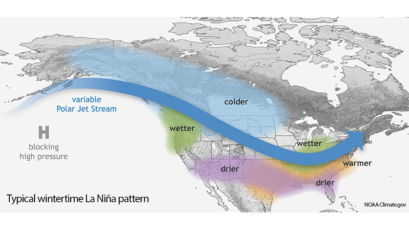
Typical La Nina patterns during winter include above-average precipitation and colder-than-average temperatures along the northern tier of the U.S. and below-normal precipitation and drier conditions across the South. NOAA’s 2017 Winter Outlook anticipated that a weak La Nina was likely to develop. Therefore, significant changes are not expected when the Winter Outlook is updated on November 16.